A Chart showing part of the Coast of NW America Side 2 - Published 1899
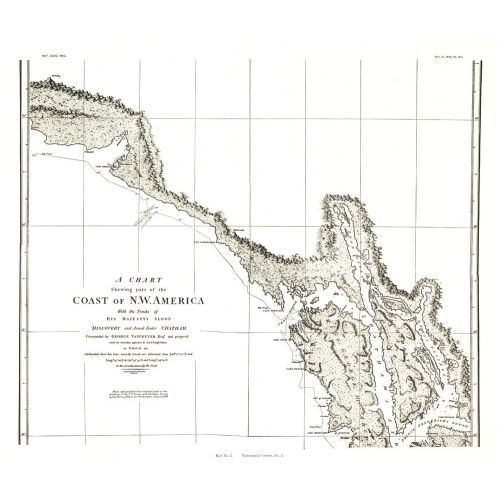
A Chart Showing Part of the Coast of NW America (Vancouver's Chart, No. 2) shows half of a chart of the coast of the Alaskan Panhandle and British Columbia including the Admiralty Island, Lynn Canal, and Prince Frederick's Sound. An antique black and white map perfect for framing, this map was published in November 1899 as half of a two-map set with the article "The Alaskan Boundary."
Details
A Chart Showing Part of the Coast of NW America (Vancouver's Chart, No. 2) shows half of a chart of the coast of the Alaskan Panhandle and British Columbia including the Admiralty Island, Lynn Canal, and Prince Frederick's Sound. An antique black and white map perfect for framing, this map was published in November 1899 as half of a two-map set with the article "The Alaskan Boundary."
More Information
| SKU | ngmaps-HM18991102-1 |
|---|---|
| Flat Size | 21 x 17.75 in |
| Publication Date | 1899 |
| Publisher Name | National Geographic |
Reviews
{{title}}
{{detail}}