Zip Codes
These ZIP codes maps come in handy while planning of deliveries, home services, sales territories, real estate, and much more. They are published in high-quality print that shows clear boundaries to distinguish different ZIP code areas. The base map features detailed information about major roads, highways, neighborhood names, railways, and high levels of land use.
-
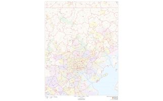
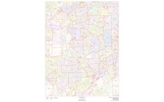
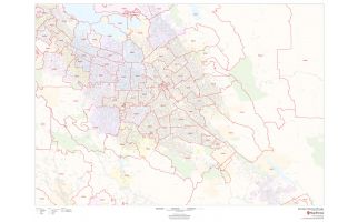 San José Zip Codes Map, California ZIP Codes
This map of San Jose shows ZIP code areas overlaid on a road map. Ideal for planning of deliveries, home services, sales territories, real estate and much more. Base map features include all roads with major roads and highways labelled; neighborhood names; railways; and high level land use such as parks and recreation areas, industrial areas and hospital campuses.
Learn MorePrice from $49.99 -
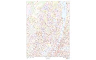
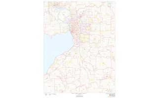
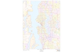 Seattle Zip Codes Map, Washington ZIP Codes
This map of Seattle shows ZIP code areas overlaid on a road map. Ideal for planning of deliveries, home services, sales territories, real estate and much more. Base map features include all roads with major roads and highways labelled; neighborhood names; railways; and high level land use such as parks and recreation areas, industrial areas and hospital campuses.
Learn MorePrice from $49.99 -
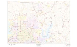
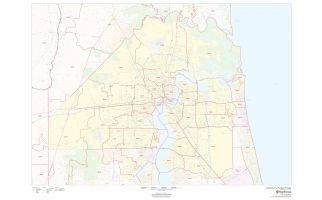
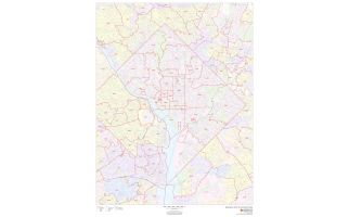 Washington Metropolitan Area ZIP Codes Map
This map of the Washington Metropolitan shows ZIP code areas overlaid on a road map. Ideal for planning of deliveries, home services, sales territories, real estate and much more. Base map features include all roads with major roads and highways labelled; neighborhood names; railways; and high level land use such as parks and recreation areas, industrial areas and hospital campuses.
This map is available in a scale of 1:25,000 in 36 x 48 inches in portrait orientation. If you want a map with different extents, or landscape orientation, or scale, you can do that by customizing the map here. If you have any questions, we will be happy to answer over the phone (866) 525-2298 or write to us Learn More
Price from $49.99 -
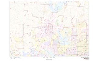
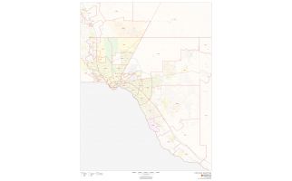
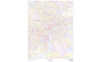 Washington Zip Codes Map, District of Columbia ZIP CodesThis is a detailed Washington, DC map showing various zip codes in the area. It marks all 5 digit zip code areas using red boundaries overlaid on the road map. The base map features include all the extensive geographic details. All roads with major roads and highways are labeled with Neighborhood names. Railways, ferry routes and high-level land use such as parks and recreation areas; industrial areas; postal districts and hospital campuses are mentioned at a detailed scale. A map legend featured at the bottom helps identify all signs and symbols used on the map.
This map is available in a scale of 1:50,000 in 36 x 48 inches in portrait orientation. If you want a map with different extents, or landscape orientation, or scale, you can do that by customizing the map here. If you have any questions, we will be happy to answer over the phone (866) 525-2298 or write to us Learn More
Price from $49.99