Canoe British Columbia Map
Customize this Canoe British Columbia Map around the area of your interest such as a business location, sales territory or anything you like. You can zoom the map in or out, center on your location through search or move it around. You can preview the map again after the adjustments before ordering. We will ship a high quality print of your selection in the orientation, size & paper finish of your choice.
We also offer a premium version of this Canoe British Columbia Map using TomTom's map data starting at $39.99. If you have any questions, we will be happy to answer over the phone (866) 525-2298 or write to us
We also offer a premium version of this Canoe British Columbia Map using TomTom's map data starting at $39.99. If you have any questions, we will be happy to answer over the phone (866) 525-2298 or write to us
Canoe BC Map
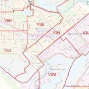
The detailed Canoe BC map is ideal for the business owner who needs local or regional road network information. It shows rich regional map data like highway infrastructure including interchanges, weighs stations, and tolls. Full street labeling highlights block numbers, street directions, and major infrastructures like airports and hospitals.
The map is available in various sizes, orientations, and finishing materials and can be used for planning deliveries, catchment area or sales territory. You can also customize this map around your preferred location like your business service area by clicking on 'Close Preview'.
About Canoe BC
The community of Canoe in British Columbia is a part of the larger City of Salmon Arm. It lies on the south of Shuswap Lake, northeast of the City Center, just off the Trans Canada Highway. The town was established in the late 1800s when the Canadian Pacific Railway was being completed and BC joined confederation with Canada. Earlier their economy was based only on agriculture and forestry. Other businesses were bought in the early 1900s.
| SKU | 9ec2ccde4ea71cd83900cdedf628c943-Canoe |
|---|---|
| Map Specification | Max Print Scale - 1:15,000 Min Print Scale - 1:2,000,000 Optimal Print Scale - All |
| Publisher Name | MapSherpa |
Write Your Own Review
Similar Products