
As we peep into the world of Map Trove, we realise it is a hub of a valuable, original and delightful collection of maps and atlases from all around the world. It subsumes hundreds of maps, each one with some distinct feature, different colour, and prospect. These maps are collected from different eminent publishers.
World maps from Map Trove collection exhibit maps and atlases from the National Geographic and these are totally worth buying. Of all the map types available, following are the sought-after ones:
Antique Style World Map:
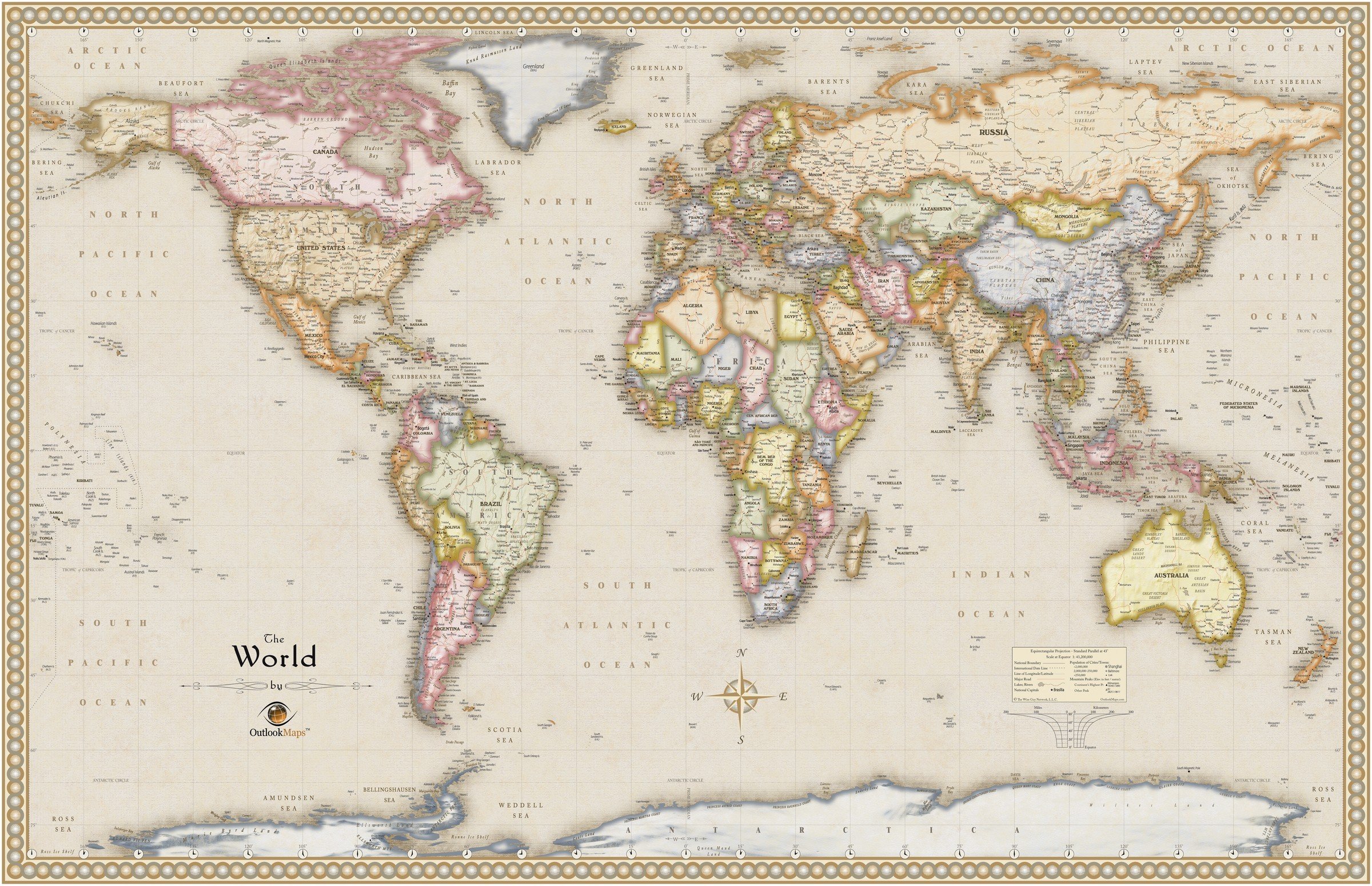
A feature that sets this map apart from other maps is its distinct antique styling. There are several aspects that are taken care of while designing antique world maps.
When it comes to its appearance, one shall find that the color of the ocean is tan brown and the image exhibits an old paper look. This also gives an idea how early cartographers designed maps using a specific uniform colour on larger sections of the paper. The shading around the coast is done with a darker gray that gives you an appearance of being hand-drawn with charcoal.
Even the colors of the countries are very unsaturated and make the map look dull. The distinctive shading done around the perimeter of country’s shape shows how ancient maps used to distinguish countries and regions.
Gray and brown colors seem to be the primary colors used for text labels and lines like rivers, coasts, and roads. The entire look of the map shows cracks, textured-surface and seems to be made out of old worn paper.
Chalk Style World Map:
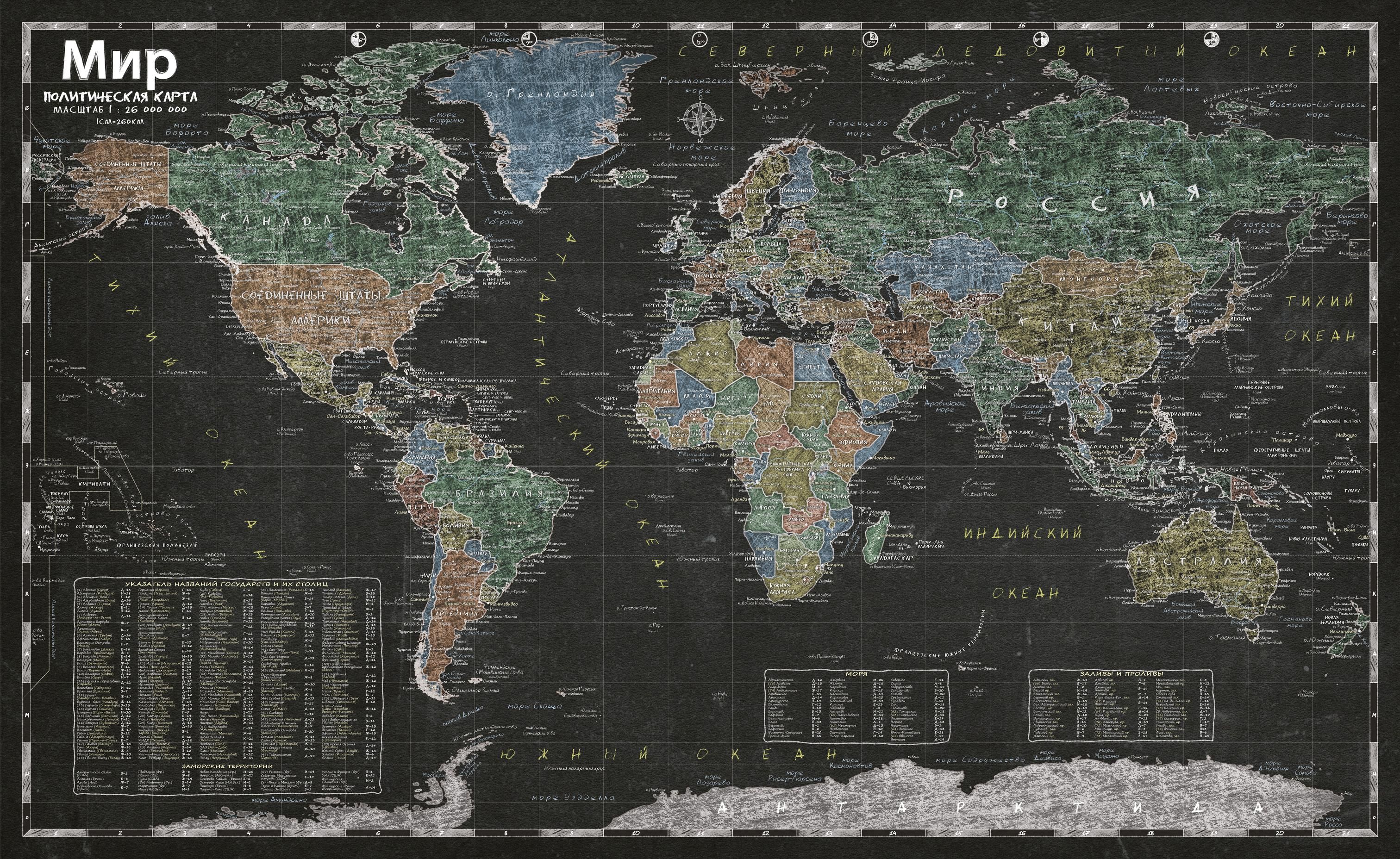
This is an unusual map style with an original design. As the name of the map asserts, it looks more like a chalkboard with the political map of the world drawn on it with various colourful chalks.
The map features an index and coordination grid which helps to find any country, water-body or any other geographical feature easily. This Russian map style was published in 2016 in two languages: English and Russian.
All the features are drawn using coloured chalk associated with land masses and water bodies. It also has a detailed index and a coordinate grid that makes searching for a country, state, sea, territory or other geographical feature easier. It displays all boundaries and time zones on large scale.
Artistic Style World Map:
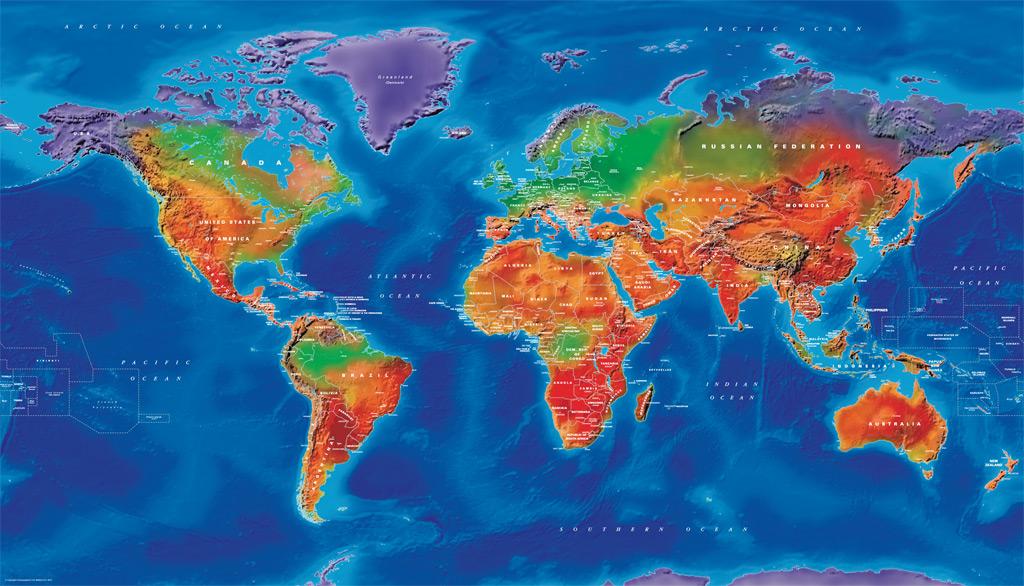
World political mapping and vibrant colours combine to make this beautiful, colourful map with a difference. These maps can be of different sizes and finishes and you can also get it on a canvas stretched to a frame.
This artistic map from Cosmographics showcases all the continents, oceans and countries using the hybrid coloured imagery with a finely detailed illustration of all the boundaries. It shows each country in a different shade according to the land and its natural colouring with physical relief and rivers highlighted. The usage of bright colours gives out an overwhelming view of the world.
It is one perfect piece of art that stands out with up-to-date details and accuracy. This art print displays sharp, vivid images with a high degree of color accuracy on paper similar to that of a postcard or greeting card.
Time Zone World Map:
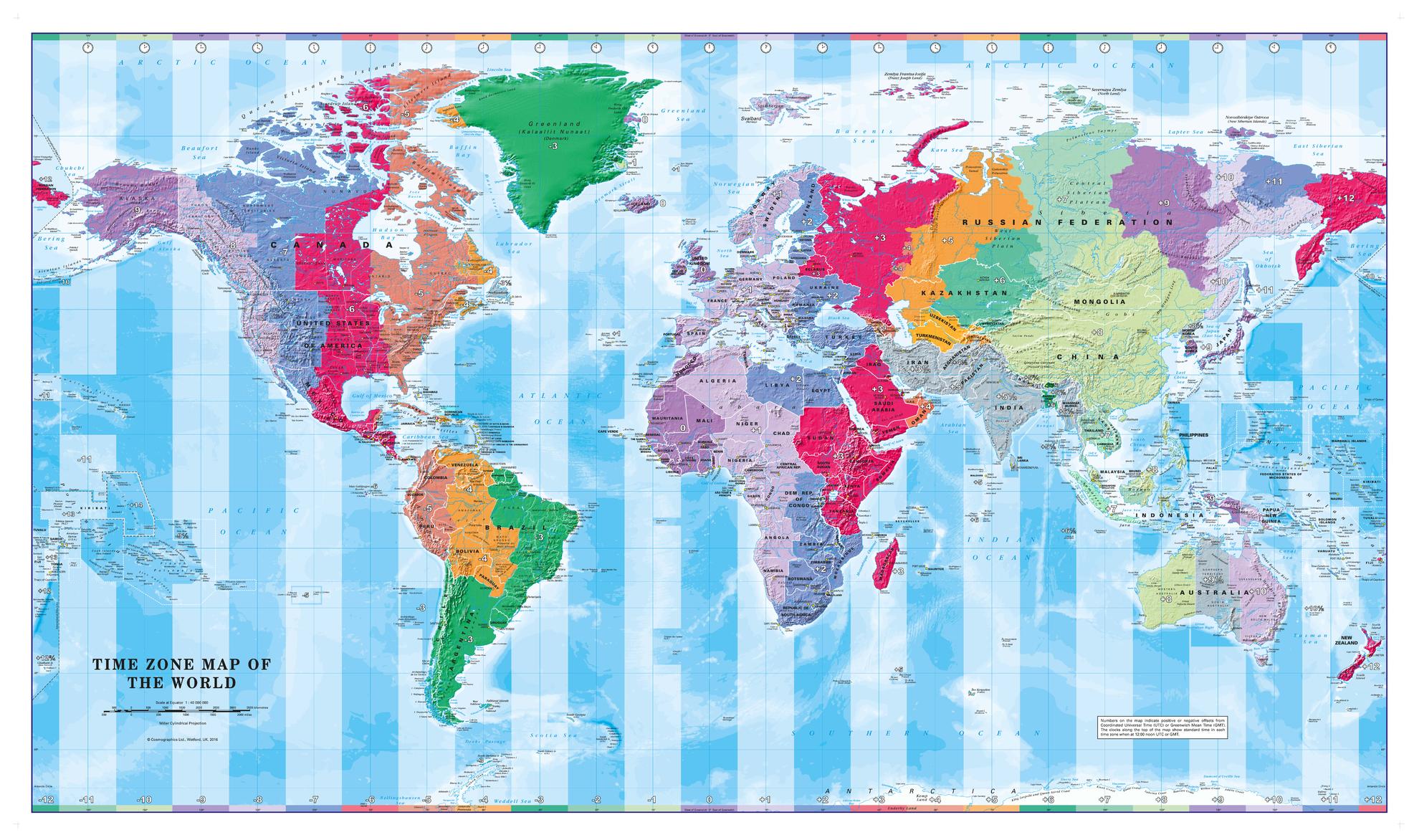
A colourful and informative map from Cosmographics that displays different time zones of the World. A simple yet interesting map that is unique from other regular World maps. A perfect art piece that can add more glam to use the room.
It is a detailed political map of the world made using contrasting colors that are used to accurately depict the time zones, both on land and in the oceans. The hour-difference is also shown in bold font. Up-to-date details and along with legible text stands out as an amazing map art.
Illustrated Trivia World Map:
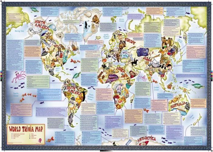
An Illustrated Trivia World Map crafted on Silk Art paper with perfect color and high-quality images drawn is published by Maps International. This map is specially crafted for children aged above 7 years for gaining knowledge by making learning a fun process.
It displays facts related to different categories associated with each particular continent, country or state. The geographical places, people, popular culture, science, nature, sport, history, world records are the topics that are displayed on this map in a legible font and bright colors with related vivid images. This map is a fully packed with information for kids to learn about the world.
World Ocean Floor Map:
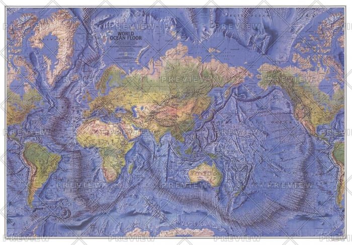
This beautiful physical map published by ‘National Geographic’ in December 1981 showcases the dramatic ocean floor topology along with Earth’s islands and oceans. It covers all the seven continents drawn using a vivid imagery and bright colored physical features.
It shows all the major underwater rifts, trenches, mountains, printed on a high-quality paper. Stunning relief shading accentuates the ocean floor, river valleys, deserts and continental shelves with amazing detail and beauty. Major vegetation is displayed that differentiates from densest forest to the barren desert. This map is the best match for schools and offices.
Illustrated Map of the World for Kids:
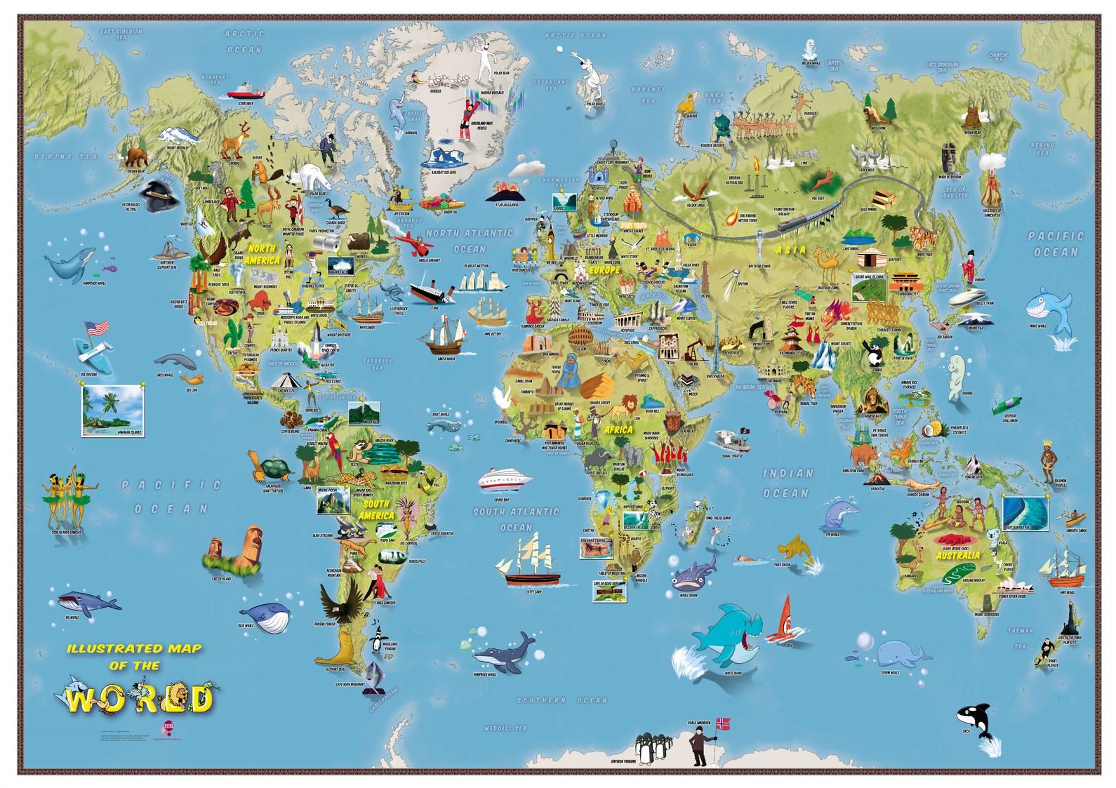
This colorful, educational map of the World is something that will keep your kids entertained for hours. This map offers a wealth of information as it is loaded with hundreds of elements – depicting points of interest such as historical facts, local interest items, cultural features, etc. Each item is individually labeled for ease of use and can be a great gift for your kids to ignite the love for maps in them.
Kids Animal Map of the World:
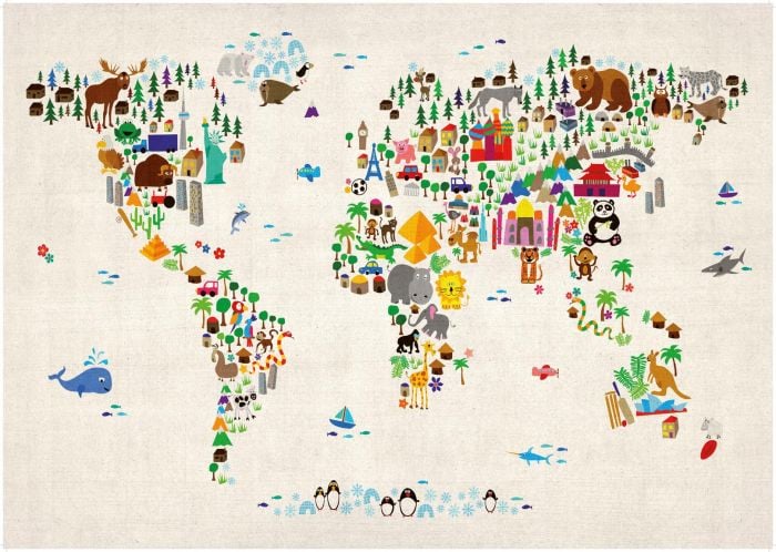
This map of the world was created from colorful animals, landmarks and other curiosities on a plain white, ivory/cream, blue or pink background.
This fine-art-ready-to-hang canvas print would be a perfect addition to any young child’s bedroom or playroom. This original and interesting gift for kids can help children learn about the world.
To ensure superb color vibrancy, only museum grade pigment inks, guaranteed fade-proof for up to 100 years (indoors or behind glass), are used in the printing process. This artwork is available as an unframed satin poster print and can make an amazing unframed luxury fine art print. One can even make a choice of four background colors – plain white, ivory/cream, blue or pink background.
World Executive Map:
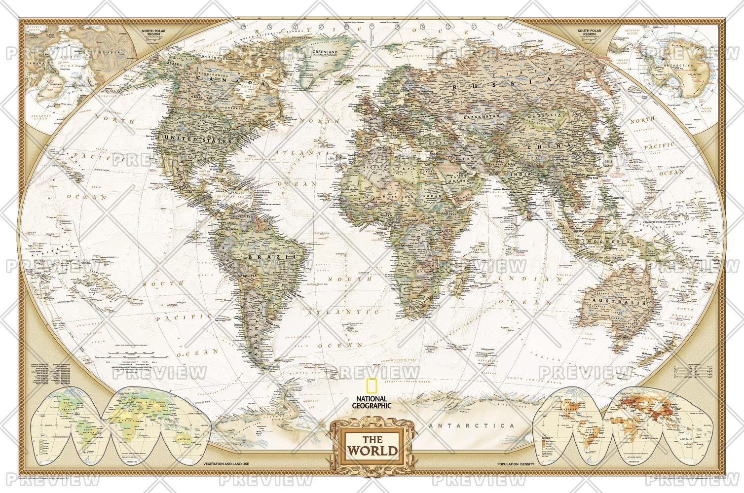
This executive world wall map includes political details (countries shaded in different tones), country boundaries and cities as shown above.
National Geographic’s world map is the standard by which all other reference maps are measured. The World map is meticulously researched and adheres to National Geographic’s convention of making independent, political decisions based on extensive research using multiple authoritative sources.
The executive style world map uses an antique-style colour palette and stunning shaded relief that provide a richness perfect for any decor. Drawn in the Winkel Tripel projection, distortions are minimised and unlike many other world maps, Greenland is shown the same size as Argentina and not as the size of all of South America.
Thousands of place names are carefully and artistically placed on the map to maintain quality even in the heavily populated areas of Europe, Asia, and the Middle East. Details include clearly defined international boundaries, cities, physical features, rivers, and ocean floor features. Corner inset maps feature vegetation and land use, and population density as well as the north and south polar regions.
World of Places Map:
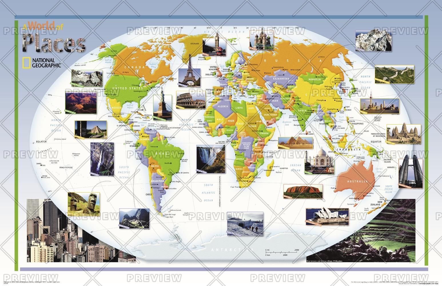
This colorful, educational ‘world of places’ map for kids and young adults features large photographs of notable landmarks and places throughout the world. This innovative world map published by National Geographic in the year 2004, is different as it includes photos of places from all around the World.
All the continents and water bodies in it are represented using bright colors and with readable text. This map is suitable for home decor, classroom or office. One can also use it as a bucket list map and pin any place when it is visited.