Top World Maps
Find every bestselling world map from eminent map publishers in one place! Ranging from legacy maps, Pacific centered maps, to the graphic world map, this collection has it all. These maps are a great source for both geographic and political information. Available in various styles like antique, classic, and contemporary they are perfect for home, business, and educational references.
-

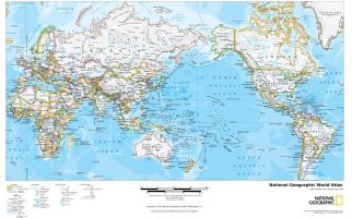 National Geographic World Atlas
The National Geographic World Atlas is a stunning map composed in high-definition. A perfect feature for home and office decor, the map shows Africa, Asia, Europe, North America, South America, the United Kingdom and the United States of America clearly. The map can be scaled down for a more realistic view of the terraneous regions. Subtle colors are used for territories and bright tones define international boundaries. The atlas enhances major political features like countries, capitals, lakes, and oceans. One can also spot icons representing major airports. Clear fonts and readable texts make it an ideal reference product.
Learn MorePrice from $21.99 -
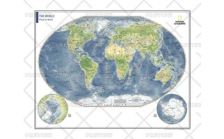
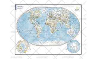
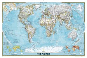 World Classic Wall Map
National Geographic's World map is the standard by which all other reference maps are measured. The World map is meticulously researched and adheres to National Geographic's convention of making independent, apolitical decisions based on extensive research using multiple authoritative source.The signature Classic style map uses a bright, easy to read color palette featuring blue oceans and stunning shaded relief that has been featured on National Geographic wall maps for over 75 years. Drawn in the Winkel Tripel projection, distortions are minimized and unlike many other World maps, Greenland is show the same size as Argentina and not as the size of all of South America.Thousands of place names are carefully and artistically placed on the map to maintain legibility even in the heavily populated areas of Europe, Asia and the Middle East. Details include clearly defined international boundaries, cities, physical features, rivers, and ocean floor features. Corner inset maps feature vegetation and land use, and population density as well as the north and south polar regions.Poster sized maps make a perfect addition to any sized space. They are specially designed to maximize content in a smaller footprint than standard wall maps and fit precisely into precut poster sized frames which makes finishing and hanging them a breeze.
Learn MorePrice from $29.99