UK Electoral Constituencies
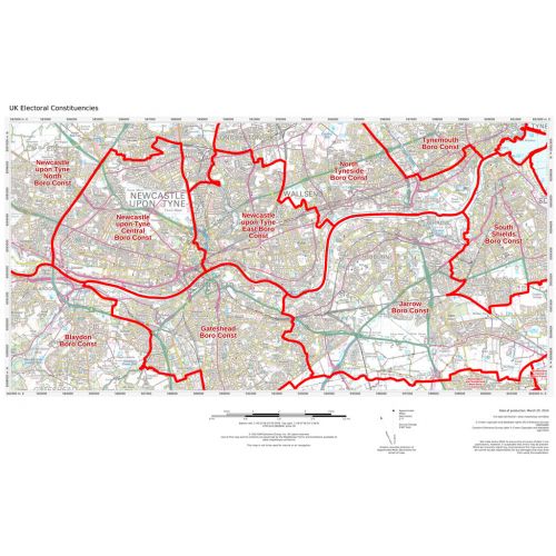
These maps highlight the electoral geography of the United Kingdom. Clearly visible Electoral Constituency boundaries and names are overlain on an Ordnance Survey backdrop map. Maps can be made of local regions which illustrate street level boundaries , to regional areas which illustrate many Constituencies and the major roads and cities. Boundary-line data is updated bi-annually (spring and fall).
Details
These maps highlight the electoral geography of the United Kingdom. Clearly visible Electoral Constituency boundaries and names are overlain on an Ordnance Survey backdrop map. Maps can be made of local regions which illustrate street level boundaries , to regional areas which illustrate many Constituencies and the major roads and cities. Boundary-line data is updated bi-annually (spring and fall).
More Information
| SKU | 2293be9a1d98ba5c88a9def8c8061958 |
|---|---|
| Map Specification | Min Print Scale - 1:500,000 Max Print Scale - 1:10,000 Note: Reflect current sitting parliament |
| Publisher Name | MapSherpa |
Reviews
{{title}}
{{detail}}