Brooks Alberta Postal Code Map
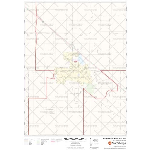
The Brooks Alberta postal code map shows the postal code areas divided using clear boundaries. The detailed base map features information about political boundaries, place names, highways, major parks, conservation areas, and points of interest. You can use this map for quick reference of infrastructures & other street details like interchanges, weigh stations and tolls. It is ideal for tracking down delivery service areas, sales territories, and catchment areas.
You can also customize this map around your preferred location by clicking on 'Close Preview'. If you have any questions, reach out to us over the phone (866) 525-2298 or write to us.
Details
Brooks Alberta Postal Code Map
You can view the political boundaries, place names, highways, major parks, and conservation areas, and other points of interest on this Brooks Alberta postal code map. You can also use it for a quick reference of infrastructures & other street details like interchanges, weigh stations and tolls. The information on this map is helpful in tracking down delivery service areas, sales territories, and catchment areas. Moreover, it assists in providing up-to-date information & is suitable to create multiple maps from city to county scales or anywhere in between.
The customizable base map allows you to create a map centered around your preferred location. You can do this by clicking on 'Close Preview' and then search for the location on the map. Use the drag and drop arrows and zoom buttons to define the print area. You can preview your map with all the details of the final print but at a much lower quality. The final map is available in high quality in various sizes and finishing materials.
About Brooks Alberta
Brooks, Alberta is surrounded by the County of Newell at an elevation of 760 m (2,490 ft). It was incorporated as a village on July 14, 1910, and then as a town on September 8, 1911. Their economy is mostly depended on energy (oil and gas) and agriculture, with other sectors including metal manufacturing, food processing and construction.
Brooks Alberta Postal Code
The postal codes in Brooks Alberta are written in "ANA NAN" format, where A is a capital letter of the alphabet and N is a number. The first three characters are regional indicators, and the second set is the local indicator. The forward sortation area or the first 3 characters of the code is T1R.
You can use this map of postal codes to:
1. Locate the nearest postal outlet.
2. Identify your federal riding and member of parliament.
3. Find the nearest bank branches and ATMs as most Canadian banks also have online tools that use postal codes.
More Information
| SKU | ecfe74dcf99c2bec1d4450323d39fec2-Brooks-P-AB |
|---|---|
| Map Specification | Max Print Scale - 1:15,000 Min Print Scale - 1:2,000,000 Optimal Print Scale - All |
| Publisher Name | MapSherpa |
Reviews
{{title}}
{{detail}}