Southern Alberta and Saskatchewan Map
Create custom map of southern Alberta and Saskatchewan from this series of attractive detailed road maps covering most of the populated areas across Canada. Maps are developed from Lucidmap’s iconic Canadian cartography. Coverage area starts at the Canada-USA border in the south, and ranges north to Lac La Biche. East-west coverage spans from North Battleford, SK to Red Deer, AB. Native scale is 1:500,000.
Details
Map of Southern Alberta and Saskatchewan
This is a custom map of Saskatchewan and Alberta that can be used to create personalised maps of the region/cities of the provinces. One can search for the places of their interest in the search option, locate them on the map, centre on the location and crop. One can preview the final print of the map and order online in paper, matte plastic and lamination.
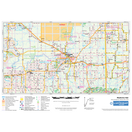
This map of Saskatchewan and Alberta is developed from Lucidmap’s iconic Canadian cartography. Coverage area starts at the Canada-USA border in the south, and ranges north to Lac La Biche. East-west coverage spans from North Battleford, SK to Red Deer, AB. The Native scale of the map is 1:500,000.
About Southern Alberta
Southern Alberta is a region located in the Canadian province of Alberta. Its primary cities are Lethbridge and Medicine Hat. Major industries operating in the region revolve mostly around agricultural production, and other sectors in alternative energy, film production and tourism and more.
About Saskatchewan
The prairie and boreal province in western Canada is the only province without natural borders. Bordered by Alberta on the west, by the Northwest Territories on the north, by Manitoba on the East, by Nunavut to the northeast, by the U.S states of Montana and North Dakota on the south, Saskatchewan's notable cities include Prince Albert, Moose Jaw, Yorkton, Swift Current, North Battleford, Melfort and the border city Lloydminster.
Landmarks and interesting places
Southern Alberta: Waterton Lakes National Park, Royal Tyrrell Museum of Palaeontology, Dinosaur Provincial Park, Waterton Lake, Head-Smashed-In Buffalo Jump, Cypress Hills, Writing-on-Stone Provincial Park, Cameron Lake, Castle Mountain Resort, Crypt Lake Trail, Crowsnest Pass, Nikka Yuko Japanese Garden, Atlas Coal Mine, Cameron Falls Drive, Upper Waterton Lake.
Saskatchewan: Grasslands National Park, Prince Albert National Park, Wascana Centre, Forestry Farm Park and Zoo, Wanuskewin Heritage Park, Royal Saskatchewan Museum, Tunnels Of Moose Jaw, Tunnels Of Moose Jaw, Fort Walsh, Little Manitou Lake, Buffalo Pound Lake, Saskatchewan Landing.
Click here to buy more Saskatchewan Province maps or Map of Saskatchewan Cities.More Information
| SKU | 350d063ad1a0d2090b5707633fe89647 |
|---|---|
| Map Specification | Maximum Print Scale - 1:250,000 Minimum Print Scale - 1:750,000 Optimal Print Scale - 1:500,000 |
| Publisher Name | Lucidmap |
Reviews
{{title}}
{{detail}}