Central Europe - Published 1951
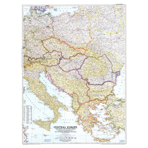
This map of Central Europe and the Balkan States captures Europe still in the recovery stages after World War II. Published in September 1951, it includes American, British, French, and Russian occupation zones and the newly drawn boundaries of Russia an
Details
This map of Central Europe and the Balkan States captures Europe still in the recovery stages after World War II. Published in September 1951, it includes American, British, French, and Russian occupation zones and the newly drawn boundaries of Russia an
More Information
| SKU | ngmaps-HM19510900-1 |
|---|---|
| Flat Size | 30.25 x 39.5 in |
| Publication Date | 1951 |
| Publisher Name | National Geographic |
Reviews
{{title}}
{{detail}}
No reviews yet ...
Have an opinion? Help others decide. Share your knowledge about this product by submitting a review.
{{/items}}
{{#previousPage}}
Previous Page
{{/previousPage}}
{{#load-more-src}}
Next Page
{{/load-more-src}}
★★★★★
★★★★★