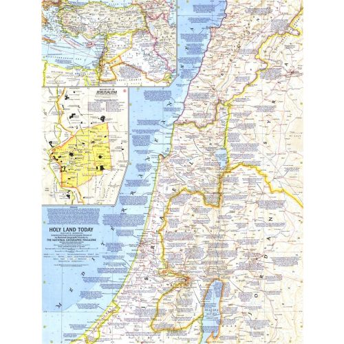
Holy Land Today - Published 1963
This map of the Holy Land provides crisp detail and an abundance of historical notes. An inset map of the Middle East shows Crusade routes, and the Walled City of Jerusalem map reveals the fourteen stations marking the way of the cross from Pilate's hall to Calvary. Published in December 1963 with the articles "Crusader Road to Jerusalem" and "Conquest of the Holy City."
Details
This map of the Holy Land provides crisp detail and an abundance of historical notes. An inset map of the Middle East shows Crusade routes, and the Walled City of Jerusalem map reveals the fourteen stations marking the way of the cross from Pilate's hall to Calvary. Published in December 1963 with the articles "Crusader Road to Jerusalem" and "Conquest of the Holy City."
More Information
| SKU | ngmaps-HM19631200-1 |
|---|---|
| Flat Size | 19 x 25 in |
| Publication Date | 1963 |
| Publisher Name | National Geographic |
Reviews
{{title}}
{{detail}}