Isle of Man Map
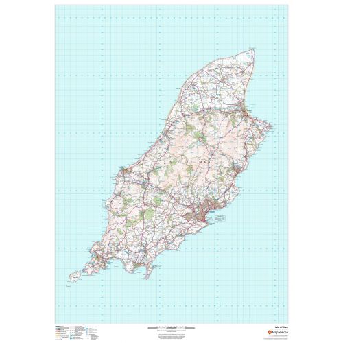
This wall map of the Isle of Man has been produced from current Ordnance Survey mapping, and displays the detailed topographic features of the island. A complete road network for the island is displayed, as well as all villages and towns including the capital Douglas. Detailed shoreline, points of interest, and waterways are displayed in recognizable Ordnance Survey styling.
Details
This wall map of the Isle of Man has been produced from current Ordnance Survey mapping, and displays the detailed topographic features of the island. A complete road network for the island is displayed, as well as all villages and towns including the capital Douglas. Detailed shoreline, points of interest, and waterways are displayed in recognizable Ordnance Survey styling.
More Information
| SKU | dmsg-brit-isleofman-1 |
|---|---|
| Map Scale | 1:50,000 |
| Flat Size | 33.25 x 47 in |
| Publication Date | 2018 |
| Publisher Name | MapSherpa |
Reviews
{{title}}
{{detail}}
No reviews yet ...
Have an opinion? Help others decide. Share your knowledge about this product by submitting a review.
{{/items}}
{{#previousPage}}
Previous Page
{{/previousPage}}
{{#load-more-src}}
Next Page
{{/load-more-src}}
★★★★★
★★★★★