Philadelphia, Pennsylvania Wall Map
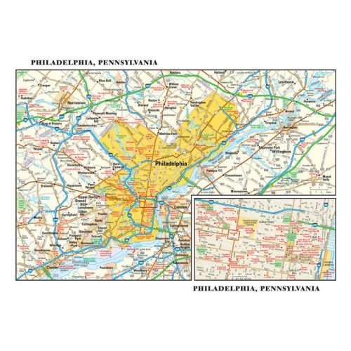
This detailed reference map combines two maps in one - a map of the greater Philadelphia area plus a street-level map of historic, downtown Philadelphia. The metropolitan map shows the area's cities and towns, highways and roads, and a variety of points of interest. The map includes the surrounding suburban cities in Pennsylvania and New Jersey. The downtown map, which includes Independence National Historical Park, shows highways, streets, parks, landmarks, and other points of interest. Society Hill and Chinatown are among the neighborhoods featured on this map.
Details
This detailed reference map combines two maps in one - a map of the greater Philadelphia area plus a street-level map of historic, downtown Philadelphia. The metropolitan map shows the area's cities and towns, highways and roads, and a variety of points of interest. The map includes the surrounding suburban cities in Pennsylvania and New Jersey. The downtown map, which includes Independence National Historical Park, shows highways, streets, parks, landmarks, and other points of interest. Society Hill and Chinatown are among the neighborhoods featured on this map.
More Information
| SKU | globeturner-GT019-CIT-PHL-16-1 |
|---|---|
| Flat Size | 11.5 x 7.75 in |
| Publication Date | 2016 |
| Publisher Name | Globe Turner |
Reviews
{{title}}
{{detail}}