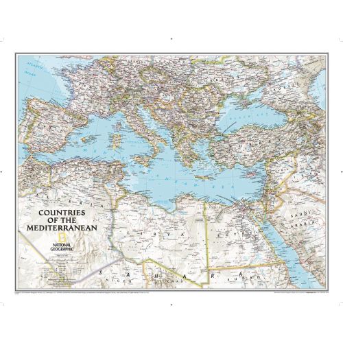
Countries of the Mediterranean Classic
This National Geographic wall map features the countries bordering the "great inland sea"- the Mediterranean. Exquisitely detailed, this reference map contains hundreds of place-names, many shown with their commonly recognized conventional (English) names. Physical geography details include shaded relief and cartographic patterns used to depict sand, lava fields, and areas below sea level. Also included are the elevations of major peaks and ocean soundings, both expressed in meters. This map also features a detailed transportation network including highways, roads, high-speed passenger railroads, and major airports.
All proceeds from the purchase of a National Geographic map help support the Society's vital exploration, conservation, scientific research, and education programs.
Details
This National Geographic wall map features the countries bordering the "great inland sea"- the Mediterranean. Exquisitely detailed, this reference map contains hundreds of place-names, many shown with their commonly recognized conventional (English) names. Physical geography details include shaded relief and cartographic patterns used to depict sand, lava fields, and areas below sea level. Also included are the elevations of major peaks and ocean soundings, both expressed in meters. This map also features a detailed transportation network including highways, roads, high-speed passenger railroads, and major airports.
All proceeds from the purchase of a National Geographic map help support the Society's vital exploration, conservation, scientific research, and education programs.
More Information
| SKU | ngmaps-RE01020760-1 |
|---|---|
| Map Scale | 1:6,957,000 |
| Flat Size | 30.25 x 23.5 inches |
| Publication Date | 2014 |
| Publisher Name | National Geographic |
Reviews
{{title}}
{{detail}}