XYZ Historical Ireland 1940s
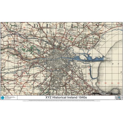
Irish Ordnance Survey 1 inch to the mile (1:63 360) mapping from the 1940s. There have been huge changes since that mean these maps give a fascinating record of a by-gone age. Converted to the modern Irish National Grid.
Details
Irish Ordnance Survey 1 inch to the mile (1:63 360) mapping from the 1940s. There have been huge changes since that mean these maps give a fascinating record of a by-gone age. Converted to the modern Irish National Grid.
More Information
| SKU | 8e326dee542cfbc0c65e80fa3b01d9ca |
|---|---|
| Map Specification | Optimum Print Scale: 1:63 000 |
| Publisher Name | XYZ Maps |
Reviews
{{title}}
{{detail}}
No reviews yet ...
Have an opinion? Help others decide. Share your knowledge about this product by submitting a review.
{{/items}}
{{#previousPage}}
Previous Page
{{/previousPage}}
{{#load-more-src}}
Next Page
{{/load-more-src}}
★★★★★
★★★★★