Oman
Details
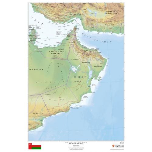
Oman map
Oman map shows all major cities including the capital city, Muscat, and surrounding countries in clear and easy to read font. Major physical and political features of the country are highlighted on the map. The height above the sea level is also depicted using relief shading and different color hues.
You can view the national flag of Oman on the bottom of the map. This flag consists of 3 stripes of white, red, and green with a red bar on the left that contains the national emblem of Oman. You can buy this detailed map in a selection of finishing materials that include paper, matte plastic, and laminate.
Where is Oman?
The Arab country of Oman is located on the southeastern coast of the Arabian Peninsula in Western Asia. Its coast is formed by the Arabian Sea on the southeast and the Gulf of Oman on the northeast. The country holds a strategically important position at the mouth of the Persian Gulf.
Major Cities in Oman
The five largest cities in the country by population are:
You can buy maps of all these cities and customize them around your central location. Click on the name of the city above to view the map.
Neighboring Countries
You can view all the bordering countries of Oman on the map. We also have separate maps of these countries listed below:More Information
| SKU | dmsg-rel-oman-1 |
|---|---|
| Map Scale | 1:2,000,000 |
| Flat Size | 24 x 36 in |
| Publication Date | 2018 |
| Publisher Name | MapSherpa |
Reviews
{{title}}
{{detail}}