Victoria, Australia State Supermap
Details
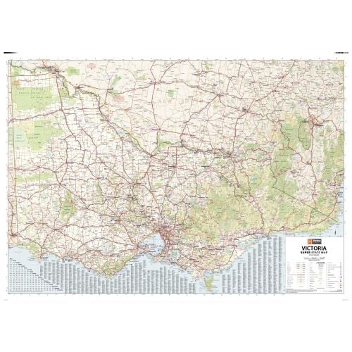
Victoria Australia Map
This Victoria Australia map measures 56.25 x 39.75 in. It is perfect for education and reference purposes. You can mount this map on the wall of your home, office, or classroom. It shows the major road networks featured along with Outback fuel, distances and major national parks.
About Victoria
Victoria in south-eastern Australia is the smallest mainland state and the second-most populous state in Australia. Majority of the population lives in the area surrounding Port Phillip Bay that includes the state capital and largest city, Melbourne.
The state of Victoria is bordered by the Bass Strait and Tasmania to the south, New South Wales to the north, the Tasman Sea to the east, and South Australia to the west.
Largest cities in the state by population are:
You can buy maps of these cities by clicking on their names above. These city maps are customizable and you can center them around your preferred location.
More Information
| SKU | hema-ZEOVIC01F-1 |
|---|---|
| Map Scale | 1:605,000 |
| Flat Size | 55.75 x 39.25 in |
| Publication Date | 2014-08-01 |
| Publisher Name | Hema Maps |
Reviews
{{title}}
{{detail}}