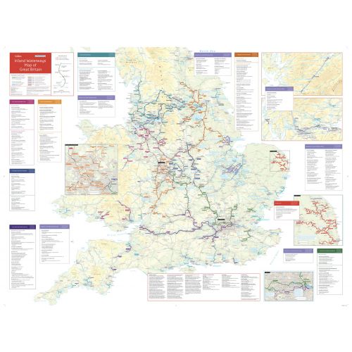
Collins Nicholson Waterways Map of Great Britain
Details
A companion map to the Collins/Nicholson Waterways Guides, which cover the entire network of canal and river navigations in England, Scotland and Wales, including newly restored/opened canals and rivers.
The map identifies:
- Narrow and broad canals
- Navigable rivers
- Tidal river navigations
- Waterways under construction
Also:
- Contact telephone numbers and dimensions for each waterway
- Internet links
- Clear insets of the Birmingham Canal Navigations, Scottish inland waterways, the Norfolk Broads and the London area
More Information
| SKU | collins-9780008363802-1 |
|---|---|
| Map Scale | 1:550,000 |
| Flat Size | 50 x 37.5 in |
| Publication Date | 2020-02-06 |
| Publisher Name | Collins |
Reviews
{{title}}
{{detail}}
No reviews yet ...
Have an opinion? Help others decide. Share your knowledge about this product by submitting a review.
{{/items}}
{{#previousPage}}
Previous Page
{{/previousPage}}
{{#load-more-src}}
Next Page
{{/load-more-src}}
★★★★★
★★★★★