France, Belgium, and The Netherlands Classic
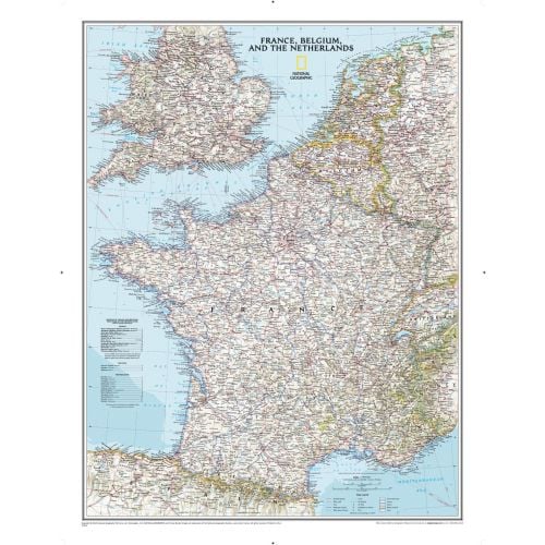
Classic wall map of France, Belgium, and the Netherlands shows political boundaries, major highways and roads, cities and towns, national parks, and a wealth of other accurate geographic detail.
Details
Classic wall map of France, Belgium, and the Netherlands shows political boundaries, major highways and roads, cities and towns, national parks, and a wealth of other accurate geographic detail.
More Information
| SKU | ngmaps-RE00622074-1 |
|---|---|
| Map Scale | 1:1,953,000 |
| Flat Size | 23.5 x 30.25 inches |
| Publication Date | 2014 |
| Publisher Name | National Geographic |
Reviews
{{title}}
{{detail}}
No reviews yet ...
Have an opinion? Help others decide. Share your knowledge about this product by submitting a review.
{{/items}}
{{#previousPage}}
Previous Page
{{/previousPage}}
{{#load-more-src}}
Next Page
{{/load-more-src}}
★★★★★
★★★★★