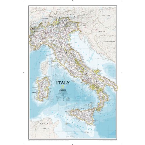
Italy Classic
Our most detailed wall map of Italy. Features thousands of place names, accurate political boundaries, major infrastructure networks such as roads, canals, aqueducts, ferry routes, airports, and railroads. Italy's diverse terrain is detailed through accurate shaded relief, coastal bathymetry, and symbolism for water features and other land forms including the outlying islands of Corsica, Elba, Isola di Pantelleria, Isola San Domino, Isola di Ustica, Isole Eolle O Lipari, Sardinia and Sicily. Elevations of major peaks are expressed in feet, depth soundings are expressed in fathoms.
Details
Our most detailed wall map of Italy. Features thousands of place names, accurate political boundaries, major infrastructure networks such as roads, canals, aqueducts, ferry routes, airports, and railroads. Italy's diverse terrain is detailed through accurate shaded relief, coastal bathymetry, and symbolism for water features and other land forms including the outlying islands of Corsica, Elba, Isola di Pantelleria, Isola San Domino, Isola di Ustica, Isole Eolle O Lipari, Sardinia and Sicily. Elevations of major peaks are expressed in feet, depth soundings are expressed in fathoms.
More Information
| SKU | ngmaps-RE00602297-1 |
|---|---|
| Map Scale | 1:1,765,000 |
| Flat Size | 23.25 x 34.25 inches |
| Publication Date | 2014 |
| Publisher Name | National Geographic |
Reviews
{{title}}
{{detail}}