Southeastern Australia - Atlas of the World, 10th Edition
Details
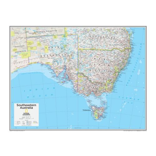
Southeastern Australia Map
View the major southeastern countries of Australia, that are, South Australia, New South Wales, Victoria, and Tasmania on this National Geographic map of Australia. The coverage of this map includes the bordering states of Northern Territory, Western Australia, and Queensland. Neighboring water bodies like the Indian Ocean, Tasman Sea, and the South Pacific Ocean are also visible.
You can buy this map for your home and offices in a selection of finishes that include paper, matte plastic, and laminate.
States in Southeastern Australia
The boundaries of Southeastern Australia stretches for 1250 miles (2000 km) across the Australian continent, from the Pacific coast of Queensland to the Southern Ocean coast in South Australia. Majority of this land comprises of rainforests, mountain ranges, scrublands, deserts, and dried-up riverbeds.
It became the most popular settlement of the colonists which caused a decline in the Aboriginal population. The four states of this region actually hold more than three-quarters of Australia's population. You can buy separate maps of these states below:
More Information
| SKU | ngmaps-POD10th107-1 |
|---|---|
| Flat Size | 28 x 22 in |
| Publication Date | 25-02-2015 |
| Publisher Name | National Geographic |
Reviews
{{title}}
{{detail}}