Britain and Ireland Classic
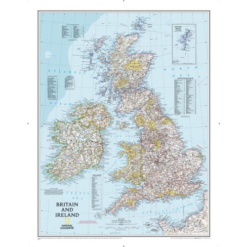
Our classic political map of Britain and Ireland shows country boundaries, thousands of place names, major highways and roads, airports, bodies of water, national parks, and more. Includes England, Ireland , Scotland, and Wales, along with Normandy across the English Channel and an inset map of the Shetland Islands.
Details
Our classic political map of Britain and Ireland shows country boundaries, thousands of place names, major highways and roads, airports, bodies of water, national parks, and more. Includes England, Ireland , Scotland, and Wales, along with Normandy across the English Channel and an inset map of the Shetland Islands.
More Information
| SKU | ngmaps-RE00602022-1 |
|---|---|
| Map Scale | 1:1,687,000 |
| Flat Size | 23.5 x 30.25 inches |
| Publication Date | 2014 |
| Publisher Name | National Geographic |
Reviews
{{title}}
{{detail}}
No reviews yet ...
Have an opinion? Help others decide. Share your knowledge about this product by submitting a review.
{{/items}}
{{#previousPage}}
Previous Page
{{/previousPage}}
{{#load-more-src}}
Next Page
{{/load-more-src}}
★★★★★
★★★★★
Related Products
Italy Classic
As low as
$34.99
Germany Classic
As low as
$31.99
Scandinavia Classic
As low as
$31.99
France, Belgium, and The Netherlands Classic
As low as
$31.99
Britain and Ireland Executive
As low as
$31.99
Germany Executive
As low as
$31.99
France, Belgium, and The Netherlands Executive
As low as
$34.99