Zannoni Map of the British Isles: England, Scotland, Ireland (1771)
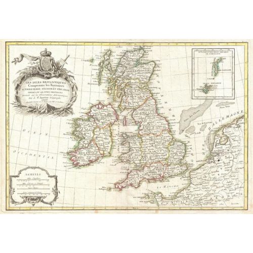
1771 map of England, Scotland and Ireland by French geographer and cartographer Jean Janvier for Jean Lattre's 1783 final issue of the Atlas Moderne. Full title: Les Iles Britanniques Comprenant les Royaumes d'Angleterre d'Ecosse et d'Irelande divisés en grandes provinces Dréssés sur les Observations Astronomiques par le Sr. Janvier Géographe
Details
1771 map of England, Scotland and Ireland by French geographer and cartographer Jean Janvier for Jean Lattre's 1783 final issue of the Atlas Moderne. Full title: Les Iles Britanniques Comprenant les Royaumes d'Angleterre d'Ecosse et d'Irelande divisés en grandes provinces Dréssés sur les Observations Astronomiques par le Sr. Janvier Géographe
More Information
| SKU | artokoloro-AM-170829-0187-1 |
|---|---|
| Flat Size | 17 x 11.75 in |
| Publication Date | 1771 |
| Publisher Name | Artokoloro |
Reviews
{{title}}
{{detail}}
No reviews yet ...
Have an opinion? Help others decide. Share your knowledge about this product by submitting a review.
{{/items}}
{{#previousPage}}
Previous Page
{{/previousPage}}
{{#load-more-src}}
Next Page
{{/load-more-src}}
★★★★★
★★★★★