England
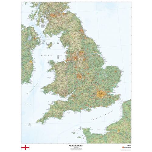
This beautiful map shows physical and political features for England and surrounding areas. Relief shading and the use of different colours by height above sea level are both informative and attractive.
Details
Flag -
Important National Days - National Day of England: St. George's Day: March 1
Provinces - London, The Southeast, Hampshire, Dorset, and, Wiltshire, Oxfordshire, the Cotswolds, and around Bristol Bath and Somerset, Devon, and, Cornwall, East, Anglia, The West Midlands and the Peak District,
Capital City - London
Major Cities - Birmingham, Manchester, Glasgow, Leeds, and, Liverpool, Canal, Newcastle upon Tyne, Sheffield, Belfast.
Continent - Europe
Currency - Pound sterling
Primary Languages - English
Time-Zone - (GMT)
Country Code - 44
Area Covered - 130,395sq km
Did you know? - England is not a separate nation as it is governed by UK. Since 1707 England has not had its own government. It has one of the largest economies in the world. Population of more than 55 million people makes it the largest geographical region in the UK.
Map of England
This beautiful map shows physical and political features for Republic of England & surrounding areas. The country that is part of the United Kingdom shares land borders with Wales to the west and Scotland to the north-northwest. England's economy is one of the largest in the world, with an average Gross Domestic Product per capita of £22,907. The country is highly industrialised and has a significant pharmaceuticals, aerospace, domestic and international aviation links.
More Information
| SKU | dmsg-rel-england-1 |
|---|---|
| Map Scale | 1:750,000 |
| Flat Size | 36 x 48 in |
| Publication Date | 2018 |
| Publisher Name | MapSherpa |
Reviews
{{title}}
{{detail}}