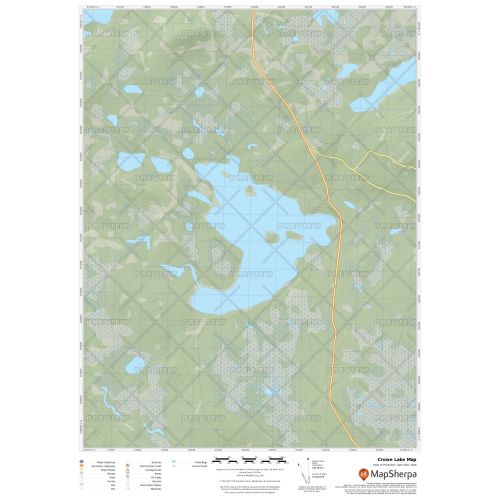
Crowe Lake Map
Crowe Lake map uses relief shading to highlight traditional topographic features like elevation contours, landforms, lakes, and rivers along with roads, rails, trails, and park boundaries. The base map shows key points of interest such as campsites, trailheads, and landmarks. You can buy this map in high-quality print in your choice of orientation, size, and finishing material. The map can also be customized around your central location.
If you have any questions, reach out to us over the phone (866) 525-2298 or write to us.
Details
Crowe Lake Map
Crowe Lake map highlight traditional topographic features like elevation contours, landforms, lakes, and rivers along with roads, rails, trails, and park boundaries using relief shading. The map exhibits beautiful cartography and covers nearby cottages, resorts and other points of interest.
You can buy this high-quality Crowe Lake map in your choice of size, orientation, and finishing materials. We also have the option to customize the map around your desired central location. Click on 'Close Preview' to edit the print area.
About Crowe Lake
The Crowe Lake in Peterborough County, Ontario has a total surface area of four square miles. It is located two miles northwest of Marmora. The lake contains a variety of fish species like walleye, bass, and bluegill. And its primary inflow is the Crowe River.
On the shores of Crowe lake is the famous Blairton Trailer Park.
More Information
| SKU | 9ec2ccde4ea71cd83900cdedf628db72-Crowe-L-NL |
|---|---|
| Map Specification | Max Print Scale - 1:15,000 Min Print Scale - 1:2,000,000 Optimal Print Scale - All |
| Publisher Name | MapSherpa |
Reviews
{{title}}
{{detail}}