Map of New England and the Canadian Maritime Provinces (1780)
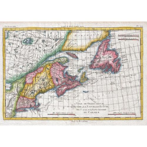
1780 map of the Canadian maritime provinces, Newfoundland, and New England by Royal Cartographer to France Rigobert Bonne (1727 - 1794), one of the most important cartographers of the late 18th century. Full title: L'Ile de Terre-Neuve, l'Acadie our la Nouvelle Ecodde, l'Ile St. Jean et la Partie Orientale du Canada
Details
1780 map of the Canadian maritime provinces, Newfoundland, and New England by Royal Cartographer to France Rigobert Bonne (1727 - 1794), one of the most important cartographers of the late 18th century. Full title: L'Ile de Terre-Neuve, l'Acadie our la Nouvelle Ecodde, l'Ile St. Jean et la Partie Orientale du Canada
More Information
| SKU | artokoloro-AM-170829-1270-1 |
|---|---|
| Flat Size | 13.75 x 9.75 in |
| Publication Date | 1780 |
| Publisher Name | Artokoloro |
Reviews
{{title}}
{{detail}}
No reviews yet ...
Have an opinion? Help others decide. Share your knowledge about this product by submitting a review.
{{/items}}
{{#previousPage}}
Previous Page
{{/previousPage}}
{{#load-more-src}}
Next Page
{{/load-more-src}}
★★★★★
★★★★★