Europe Executive
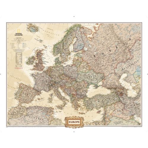
National Geographic's antique-executive style political map of Europe features country boundaries, thousands of place names, waterbodies, airports, major highways and roads, national parks, and much more. Includes the countries and major cities of Albania, Armenia, Austria, Azerbaijan, Belarus, Belgium, Bosnia & Herzegovina, Bulgaria, Croatia, Cyprus, Czech Republic, Denmark, Estonia, Finland, France, Georgia, Germany, Greece, Hungary, Iceland, Ireland, Italy, Kosovo, Latvia, Liechtenstein, Lithuania, Luxembourg, Macedonia, Moldova, Montenegro, The Netherlands, Norway, Poland, Portugal, Romania, Russia, Serbia, Slovakia, Slovenia, Spain, Sweden, Switzerland, Turkey, Ukraine, and the United Kingdom.
Details
National Geographic's antique-executive style political map of Europe features country boundaries, thousands of place names, waterbodies, airports, major highways and roads, national parks, and much more. Includes the countries and major cities of Albania, Armenia, Austria, Azerbaijan, Belarus, Belgium, Bosnia & Herzegovina, Bulgaria, Croatia, Cyprus, Czech Republic, Denmark, Estonia, Finland, France, Georgia, Germany, Greece, Hungary, Iceland, Ireland, Italy, Kosovo, Latvia, Liechtenstein, Lithuania, Luxembourg, Macedonia, Moldova, Montenegro, The Netherlands, Norway, Poland, Portugal, Romania, Russia, Serbia, Slovakia, Slovenia, Spain, Sweden, Switzerland, Turkey, Ukraine, and the United Kingdom.
More Information
| SKU | ngmaps-RE00620323-1 |
|---|---|
| Map Scale | 1:8,425,000 |
| Flat Size | 30.5 x 24 inches |
| Publication Date | 2011 |
| Publisher Name | National Geographic |
Reviews
{{title}}
{{detail}}