Great Bear Lake Map
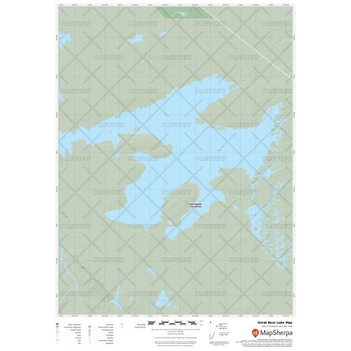
Great Bear Lake map uses relief shading to highlight traditional topographic features like elevation contours, landforms, lakes, and rivers along with roads, rails, trails, and park boundaries. The base map shows key points of interest such as campsites, trailheads, and landmarks. You can buy this map in high-quality print in your choice of orientation, size, and finishing material. The map can also be customized around your central location.
If you have any questions, reach out to us over the phone (866) 525-2298 or write to us.
Details
Great Bear Lake Map
The Great Bear Lake map uses relief shading to highlight traditional topographic features like elevation contours, landforms, lakes, and rivers. It marks nearby cottages, resorts and other points of interest. You can find information about key points of interest such as campsites, trailheads, and landmarks on the detailed base map. You can also view the Deline settlement on the lake, near the headwaters of the Bear River.
The map can be customized around your preferred location by clicking on 'Close Preview'. You can buy this map in high-quality print in your choice of orientation, size, and finishing material.
About Great Bear Lake
Great Bear Lake is situated in the Canadian province of Northwest Territories. It is the largest lake situated entirely in Canada, the fourth-largest in North America, and the eighth-largest in the world. Lake covers an area of 31,328 km2 (12,096 sq mi) and has a surface elevation of 156 m (512 ft). It is also known for its considerable clearness.
The rivers flowing into Great Bear Lake include the Whitefish River, Big Spruce River, Haldane River, Bloody River, Sloan River, Dease River, and the Johnny Hoe River.
More Information
| SKU | 9ec2ccde4ea71cd83900cdedf628db72-Gt-Bear-L-NT |
|---|---|
| Map Specification | Max Print Scale - 1:15,000 Min Print Scale - 1:2,000,000 Optimal Print Scale - All |
| Publisher Name | MapSherpa |
Reviews
{{title}}
{{detail}}