Japan Executive
Details
Flag -
Country full name - State of Japan
Important National Days - National Foundation Day: 11th February, Coming-of-age Day: 14th January
Capital City - Tokyo
Continent - Asia
Currency - Japanese Yen
Primary Languages - Japanese
Time-Zone - (GMT+9)
ISO CODE - JPN
Country Code - 81
Area Covered - 377,972 sq km
Neighbouring Countries - China, North Korea, South Korea
National Mapping Agency - Geospatial Information Authority of Japan (GSI)
Did you know? - Japan is an archipelago that is made up of 6852 islands. More than a thousand earthquakes hit Japan every year. Mount Fuji is the tallest mountain in Japan. It is one of the most densely populated countries on earth.
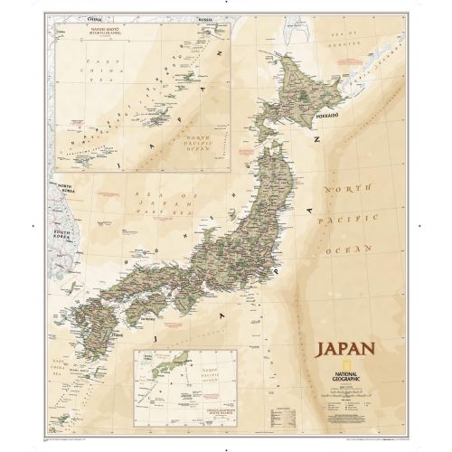
Japan Map
This executive-style Japan map shows political boundaries, major highways and roads, cities and towns, airports, and other geographic details. Thousands of place-names and exact borders are carefully researched by National Geographic's map researchers and editors ensuring the utmost accuracy. The country is considered a great power and its economy is the world's third-largest by nominal GDP and the fourth-largest by purchasing power parity. Japan is also known as the world's fourth-largest exporter and fourth-largest importer.
More Information
| SKU | ngmaps-RE01020673-1 |
|---|---|
| Map Scale | 1:3,100,000 |
| Flat Size | 25 x 29.25 inches |
| Publication Date | 2012 |
| Publisher Name | National Geographic |
Reviews
{{title}}
{{detail}}