Lake Champlain Map
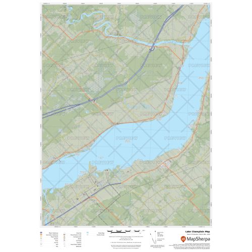
Lake Champlain map uses relief shading to highlight traditional topographic features like elevation contours, landforms, lakes, and rivers along with roads, rails, trails, and park boundaries. The base map shows key points of interest such as campsites, trailheads, and landmarks. You can buy this map in high-quality print in your choice of orientation, size, and finishing material. The map can also be customized around your central location.
If you have any questions, reach out to us over the phone (866) 525-2298 or write to us.
Details
Lake Champlain Map
Lake Champlain is situated in the Canadian province of Quebec. The lake covers an area of 1,269 km2 (490 sq mi) and has a surface elevation of 29 to 30 m (95 to 100 ft). Buy this lake map online in different finishing options including paper, matte plastic and lamination at MapTrove.
More Information
| SKU | 9ec2ccde4ea71cd83900cdedf628db72-Champ-L-QC |
|---|---|
| Map Specification | Max Print Scale - 1:15,000 Min Print Scale - 1:2,000,000 Optimal Print Scale - All |
| Publisher Name | MapSherpa |
Reviews
{{title}}
{{detail}}