Lighthouses and Sailing Routes, Pacific Coast (1906)
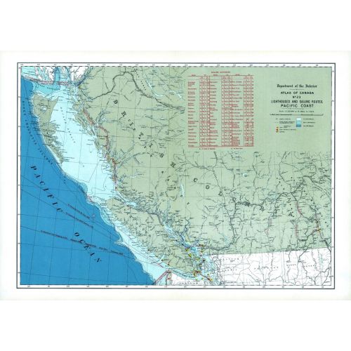
Contained within the 1st Edition (1906) of the Atlas of Canada is a map that shows the lighthouses, as well as sailing routes along the Pacific Coast, circa 1906. There are routes that sailing distances are given from the principal ocean ports of Canada to the other great ocean ports of the world. A table gives the distance, in miles, to Vancouver and Victoria from other major ports. The lighthouses are distinguished between fixed and revolving lights, and light ships. The depth of the water along the coast line is indicated by contours and tints of blue. The deeper portions are shown in the darker tints, while lighter tints indicate shallow waters.
Details
Contained within the 1st Edition (1906) of the Atlas of Canada is a map that shows the lighthouses, as well as sailing routes along the Pacific Coast, circa 1906. There are routes that sailing distances are given from the principal ocean ports of Canada to the other great ocean ports of the world. A table gives the distance, in miles, to Vancouver and Victoria from other major ports. The lighthouses are distinguished between fixed and revolving lights, and light ships. The depth of the water along the coast line is indicated by contours and tints of blue. The deeper portions are shown in the darker tints, while lighter tints indicate shallow waters.
More Information
| SKU | nrcan-294043-1 |
|---|---|
| Map Scale | 1:2,217,600 |
| Flat Size | 24 x 17.25 in |
| Publication Date | 1906 |
| Publisher Name | Natural Resources Canada |
Reviews
{{title}}
{{detail}}