Boston, Massachusetts Wall Map
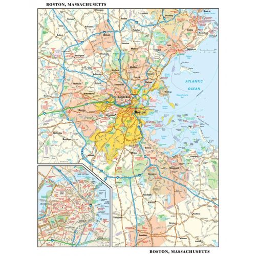
This detailed reference map combines two maps in one - a regional map of the Boston metropolitan area plus a street-level map of center-city Boston. The regional map shows the area's cities and towns, highways and roads, and a variety of points of interest. Cambridge, Quincy, Salem and historic Lexington are among the neighboring cities and towns shown on this map. The highly detailed inset of central Boston shows highways, streets, parks, landmarks, and other points of interest. The North End, West End, Beacon Hill, and Chinatown are among the neighborhoods featured on this map.
Details
This detailed reference map combines two maps in one - a regional map of the Boston metropolitan area plus a street-level map of center-city Boston. The regional map shows the area's cities and towns, highways and roads, and a variety of points of interest. Cambridge, Quincy, Salem and historic Lexington are among the neighboring cities and towns shown on this map. The highly detailed inset of central Boston shows highways, streets, parks, landmarks, and other points of interest. The North End, West End, Beacon Hill, and Chinatown are among the neighborhoods featured on this map.
More Information
| SKU | globeturner-GT014-CIT-BOS-16-1 |
|---|---|
| Flat Size | 11.5 x 14.5 in |
| Publication Date | 2016 |
| Publisher Name | Globe Turner |
Reviews
{{title}}
{{detail}}