Mexico, Central America and the West Indies - Published 1939
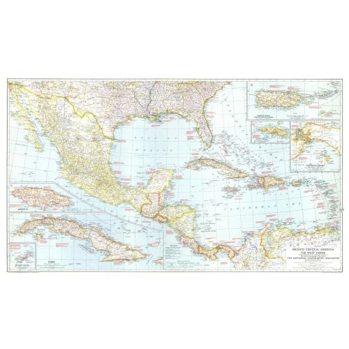
The map of Mexico, Central America and the West Indies published in National Geographic Magazine in December 1939 accompanied the article "Puerto Rico: Watchdog of the Caribbean." A wealth of historical notes dot this map, including the dates of the the founding of many cities, the explorers who named them, Aztec and Maya sites, and more.
Details
The map of Mexico, Central America and the West Indies published in National Geographic Magazine in December 1939 accompanied the article "Puerto Rico: Watchdog of the Caribbean." A wealth of historical notes dot this map, including the dates of the the founding of many cities, the explorers who named them, Aztec and Maya sites, and more.
More Information
| SKU | ngmaps-HM19391200-1 |
|---|---|
| Flat Size | 41.5 x 25 in |
| Publication Date | 1939 |
| Publisher Name | National Geographic |
Reviews
{{title}}
{{detail}}
No reviews yet ...
Have an opinion? Help others decide. Share your knowledge about this product by submitting a review.
{{/items}}
{{#previousPage}}
Previous Page
{{/previousPage}}
{{#load-more-src}}
Next Page
{{/load-more-src}}
★★★★★
★★★★★