Mount Everest 50th Anniversary: Side 1
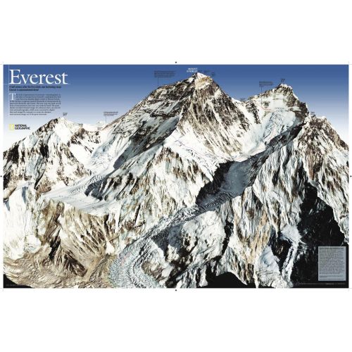
As seen in the May 2003 issue of NATIONAL GEOGRAPHIC, this map celebrates the 50th anniversary of Sir Edmund Hillary's ascent to the summit of Mt. Everest. A view of the mountain This side features a digital rendering of Mount Everest created from infrared images taken by the space shuttle combined with stereo photographs taken from a jet aircraft.
Details
As seen in the May 2003 issue of NATIONAL GEOGRAPHIC, this map celebrates the 50th anniversary of Sir Edmund Hillary's ascent to the summit of Mt. Everest. A view of the mountain This side features a digital rendering of Mount Everest created from infrared images taken by the space shuttle combined with stereo photographs taken from a jet aircraft.
More Information
| SKU | ngmaps-RE00620098A-1 |
|---|---|
| Map Scale | 1:90,000 |
| Flat Size | 31.75 x 20.75 inches |
| Publication Date | 2010 |
| Publisher Name | National Geographic |
Reviews
{{title}}
{{detail}}
No reviews yet ...
Have an opinion? Help others decide. Share your knowledge about this product by submitting a review.
{{/items}}
{{#previousPage}}
Previous Page
{{/previousPage}}
{{#load-more-src}}
Next Page
{{/load-more-src}}
★★★★★
★★★★★