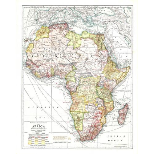
Africa map - Published 1909
This historic map of Africa takes you back to 1909, a time when the "Dark Continent" was barely known in the outside world. A time when the only way to get to far off places like Abyssinia, the Congo State, and Bechuanaland Protectorate was to take a long sea voyage, then travel many miles by rail. National Geographic was among the first to bring this amazing land to the world, and this incredible map provides a time capsule into these times. Artistic cartography and painstaking detail make this a map for any collector.
Details
This historic map of Africa takes you back to 1909, a time when the "Dark Continent" was barely known in the outside world. A time when the only way to get to far off places like Abyssinia, the Congo State, and Bechuanaland Protectorate was to take a long sea voyage, then travel many miles by rail. National Geographic was among the first to bring this amazing land to the world, and this incredible map provides a time capsule into these times. Artistic cartography and painstaking detail make this a map for any collector.
More Information
| SKU | ngmaps-HM19090300-1 |
|---|---|
| Flat Size | 17 x 21.5 in |
| Publication Date | 1909 |
| Publisher Name | National Geographic |
Reviews
{{title}}
{{detail}}