Europe - Published 1969
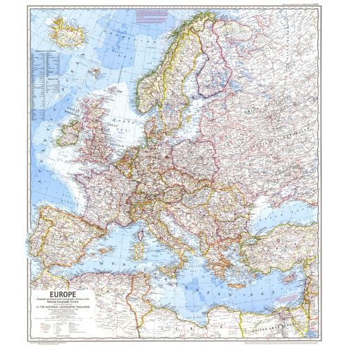
In comparison to earlier maps of Europe, this map is the first to show the network of superhighways criss-crossing the continent as European transportation surged. Published in June 1969, it accompanied an article entitled "Europe, A Restless Continent Remapped."
Details
In comparison to earlier maps of Europe, this map is the first to show the network of superhighways criss-crossing the continent as European transportation surged. Published in June 1969, it accompanied an article entitled "Europe, A Restless Continent Remapped."
More Information
| SKU | ngmaps-HM19690600-1 |
|---|---|
| Flat Size | 26.75 x 30.25 in |
| Publication Date | 1969 |
| Publisher Name | National Geographic |
Reviews
{{title}}
{{detail}}
No reviews yet ...
Have an opinion? Help others decide. Share your knowledge about this product by submitting a review.
{{/items}}
{{#previousPage}}
Previous Page
{{/previousPage}}
{{#load-more-src}}
Next Page
{{/load-more-src}}
★★★★★
★★★★★