North America Political Wall Map
Details
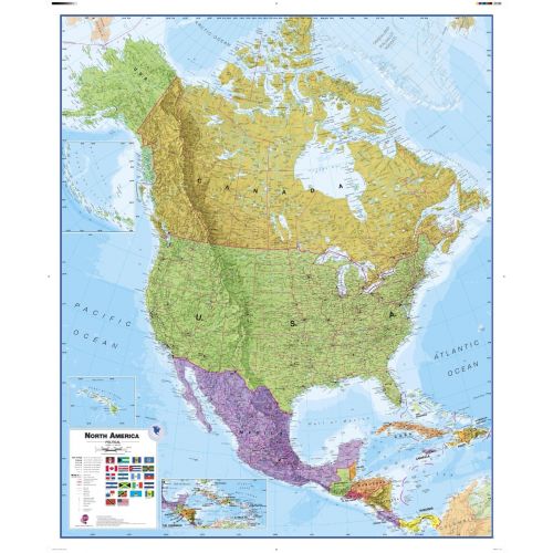
Maps International's North America political wall map covers a huge expanse of land from Alaska and Canada through the United States down to Mexico, Central America and the Caribbean. North American political map detail: This political wall map of North America features countries shown in different colours, international boundaries and major transport networks. The wall map also contains a panel of flags relating to the countries shown in this North American continent map. Also shown is city population detail, capital cities and all the major towns and cities in this continent of North America.
More Information
| SKU | lovelljohns-CT00018_L-1 |
|---|---|
| Map Scale | 1:7,000,000 |
| Flat Size | 39.5 x 47.25 in |
| Publication Date | 2016 |
| Publisher Name | Maps International |
Reviews
{{title}}
{{detail}}
No reviews yet ...
Have an opinion? Help others decide. Share your knowledge about this product by submitting a review.
{{/items}}
{{#previousPage}}
Previous Page
{{/previousPage}}
{{#load-more-src}}
Next Page
{{/load-more-src}}
★★★★★
★★★★★