Northern Plains Map Side 2 - Published 1986
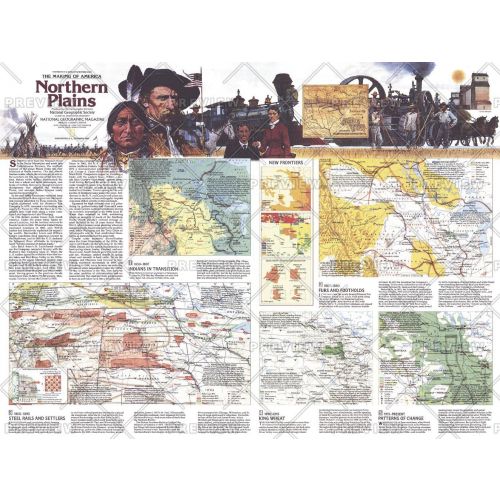
Published in December 1986, this map of the Northern Plains represents Side Two in a two-map set in the "Making of America" series. Multiple maps illustrate the region's change from the buffalo ranges and hunting grounds of the Plains Indian tribes to the agriculture, petroleum, mining, and manufacturing industries today.
Details
Published in December 1986, this map of the Northern Plains represents Side Two in a two-map set in the "Making of America" series. Multiple maps illustrate the region's change from the buffalo ranges and hunting grounds of the Plains Indian tribes to the agriculture, petroleum, mining, and manufacturing industries today.
More Information
| SKU | ngmaps-HM19861202-1 |
|---|---|
| Flat Size | 27 x 20.5 in |
| Publication Date | 1986 |
| Publisher Name | National Geographic |
Reviews
{{title}}
{{detail}}
No reviews yet ...
Have an opinion? Help others decide. Share your knowledge about this product by submitting a review.
{{/items}}
{{#previousPage}}
Previous Page
{{/previousPage}}
{{#load-more-src}}
Next Page
{{/load-more-src}}
★★★★★
★★★★★
Related Products
Northern Plains Map Side 1 - Published 1986
As low as
$31.99
Northern Canada Wall Map in English & French - Large
As low as
$44.99
Making of Canada, the North - Published 1997
As low as
$27.99
Making of Canada, Yukon and Northwest Territories - Pub...
As low as
$27.99
Northern Canada Map
As low as
$49.99
Pinkerton Map of British North America or Canada (1818)
As low as
$24.99