Raynal and Bonne Map of British Isles (1780)
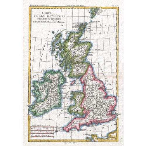
1780 map of the British Isles by Royal Cartographer to France Rigobert Bonne (1727 - 1794), one of the most important cartographers of the late 18th century. Full title: Carte des Iles Britanniques contenant les Royaumes d'Angleterre, d'Ecosee et d'Irelande.
Details
1780 map of the British Isles by Royal Cartographer to France Rigobert Bonne (1727 - 1794), one of the most important cartographers of the late 18th century. Full title: Carte des Iles Britanniques contenant les Royaumes d'Angleterre, d'Ecosee et d'Irelande.
More Information
| SKU | artokoloro-AM-170829-1257-1 |
|---|---|
| Flat Size | 9.5 x 13.75 in |
| Publication Date | 1780 |
| Publisher Name | Artokoloro |
Reviews
{{title}}
{{detail}}
No reviews yet ...
Have an opinion? Help others decide. Share your knowledge about this product by submitting a review.
{{/items}}
{{#previousPage}}
Previous Page
{{/previousPage}}
{{#load-more-src}}
Next Page
{{/load-more-src}}
★★★★★
★★★★★