Canada National Parks Map
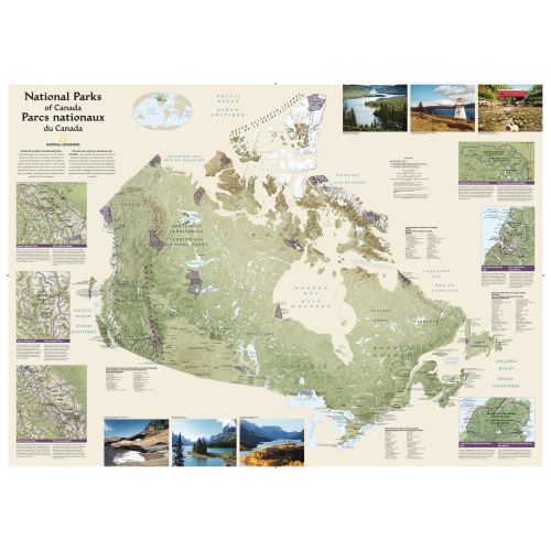
Wall map of Canada's National Parks highlighting the magnificent parks across the country. Colorful photos capture some of the diverse landscapes preserved and protected by the national park system. Separate inset maps provide detail and descriptions of several of the parks including Jasper, Yoho, Banff, Riding Mountain, Gros Morne and Cape Breton Highlands.
Details
Wall map of Canada's National Parks highlighting the magnificent parks across the country. Colorful photos capture some of the diverse landscapes preserved and protected by the national park system. Separate inset maps provide detail and descriptions of several of the parks including Jasper, Yoho, Banff, Riding Mountain, Gros Morne and Cape Breton Highlands.
More Information
| SKU | ngmaps-RE01020680-1 |
|---|---|
| Map Scale | 1:6,400,000 |
| Flat Size | 42 x 30 inches |
| Publication Date | 2012 |
| Publisher Name | National Geographic |
Reviews
{{title}}
{{detail}}
No reviews yet ...
Have an opinion? Help others decide. Share your knowledge about this product by submitting a review.
{{/items}}
{{#previousPage}}
Previous Page
{{/previousPage}}
{{#load-more-src}}
Next Page
{{/load-more-src}}
★★★★★
★★★★★