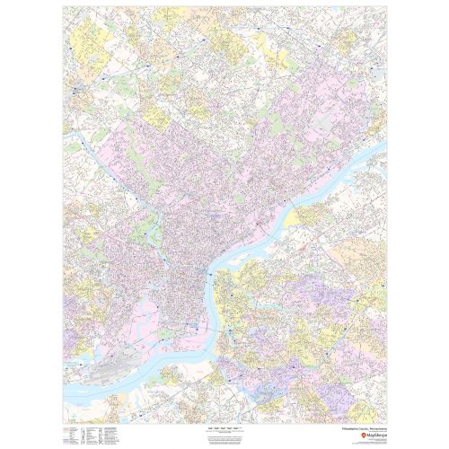
Philadelphia County Zip Code Map, Pennsylvania
This map of Philadelphia County, Pennsylvania shows street level information including street labeling. Base map features include all roads with major roads and highways labelled; neighborhood names; railways; high level land use such as parks and recreation areas, industrial areas and hospital campuses; and a variety of points of interest including libraries, stadiums, museums, border crossings and more. ZIP code boundaries are shown as a secondary map feature.
Details
Philadelphia County, Pennsylvania Map shows street level info including street labeling, neighborhood names, railways, points of interest including libraries, Etc, Visit Online Store of Maptrove.
More Information
| SKU | dmsg-county-str-philadelphia-PA-1 |
|---|---|
| Map Scale | 1:35,000 |
| Flat Size | 36 x 48 in |
| Publication Date | 2018 |
| Publisher Name | MapSherpa |
Reviews
{{title}}
{{detail}}
No reviews yet ...
Have an opinion? Help others decide. Share your knowledge about this product by submitting a review.
{{/items}}
{{#previousPage}}
Previous Page
{{/previousPage}}
{{#load-more-src}}
Next Page
{{/load-more-src}}
★★★★★
★★★★★
Related Products
Suffolk County Zip Code Map, New York
As low as
$49.99
Suffolk County Zip Code Map, New York ZIP Codes
As low as
$49.99
Allegheny County, Pennsylvania Map
As low as
$49.99
Map of Pennsylvania
As low as
$22.99
Philadelphia, Pennsylvania Wall Map
As low as
$22.99
Philadelphia Zip Codes Map, Pennsylvania ZIP Codes
As low as
$49.99
Central Philadelphia Map, Pennsylvania - Portrait
As low as
$49.99
Central Philadelphia Map, Pennsylvania - Landscape
As low as
$49.99
Philadelphia County Zip Code Map, Pennsylvania ZIP Codes
As low as
$49.99