Maryland, Delaware and District of Columbia Map - Published 1927
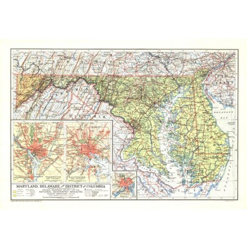
Published in February 1927, the Maryland, Delaware and District of Columbia map contains detailed insets of the cities of Baltimore, Wilmington, and Washington. The weight of type used for names gives a clue to the population of the cities at the time.
Details
Published in February 1927, the Maryland, Delaware and District of Columbia map contains detailed insets of the cities of Baltimore, Wilmington, and Washington. The weight of type used for names gives a clue to the population of the cities at the time.
More Information
| SKU | ngmaps-HM19270200-1 |
|---|---|
| Flat Size | 19.75 x 13.5 in |
| Publication Date | 1927 |
| Publisher Name | National Geographic |
Reviews
{{title}}
{{detail}}
No reviews yet ...
Have an opinion? Help others decide. Share your knowledge about this product by submitting a review.
{{/items}}
{{#previousPage}}
Previous Page
{{/previousPage}}
{{#load-more-src}}
Next Page
{{/load-more-src}}
★★★★★
★★★★★