Close-up USA, Maine Map - Published 1975
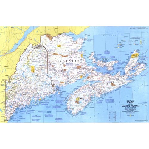
This map details Maine, the most northeastern state in the United States, as well as the surrounding Canadian maritime provinces of New Brunswick, Nova Scotia, and Prince Edward Island. Includes a wealth of notes about the festivals, events, and historical sites one can visit in this scenic region. Published in March 1975 as part of the "Close-up: U.S.A." series, with a companion travel poster and an article on Nova Scotia.
Details
This map details Maine, the most northeastern state in the United States, as well as the surrounding Canadian maritime provinces of New Brunswick, Nova Scotia, and Prince Edward Island. Includes a wealth of notes about the festivals, events, and historical sites one can visit in this scenic region. Published in March 1975 as part of the "Close-up: U.S.A." series, with a companion travel poster and an article on Nova Scotia.
More Information
| SKU | ngmaps-HM19750301-1 |
|---|---|
| Flat Size | 35.25 x 22.75 in |
| Publication Date | 1975 |
| Publisher Name | National Geographic |
Reviews
{{title}}
{{detail}}