Map of Quebec, St. John, Winnipeg (1906)
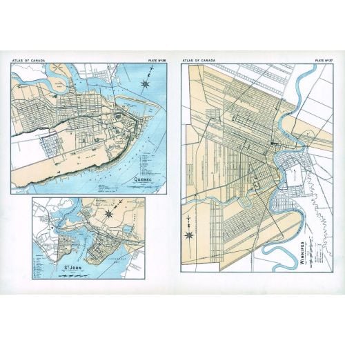
Contained within the 1st Edition (1906) of the Atlas of Canada is a plate that has three maps. The first map is of the city of Quebec, the second map is of the city of St. John and the third map is of the city of Winnipeg. At this time these cities had a population over 25, 000. The map indicates the location of city wards, electric railways, and churches symbolized as crosses.
Details
Contained within the 1st Edition (1906) of the Atlas of Canada is a plate that has three maps. The first map is of the city of Quebec, the second map is of the city of St. John and the third map is of the city of Winnipeg. At this time these cities had a population over 25, 000. The map indicates the location of city wards, electric railways, and churches symbolized as crosses.
More Information
| SKU | nrcan-294055-1 |
|---|---|
| Flat Size | 24.25 x 17.25 in |
| Publication Date | 1906 |
| Publisher Name | Natural Resources Canada |
Reviews
{{title}}
{{detail}}