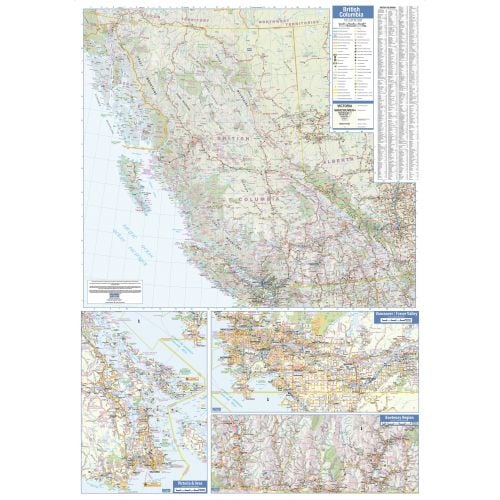
British Columbia Wall Map - Large
This large wall map has been designed to show important features in British Columbia, including all highways, cities and towns, major parks, political boundaries, and points of interest.
The map has been designed with a traditional Canadian style embraced by map buyers over many years.
Details
Detailed Map of BC
This mega-size wall map of BC Canada updated with important features like the location of major cities, towns, highways, major parks, tourist places, recreation areas, interesting points, political boundaries & more. The map is a great source of information for those who look around for maps & atlases to locate places of their interest. For easy map reading, a detailed legend is provided with symbols denoting landmarks & other hundreds of geographic details. Terrain topography is also visible on the map to denote distinct land areas. You can order this map in 38 x 54 inches dimension in paper, matte plastic & lamination.
Nearby Cities
Vancouver, White Rock, Port Coquitlam
Landmarks & Important buildings
Stanley Park, Capilano Suspension Bridge, Okanagan Lake, Royal BC Museum, Butchart Gardens, Whistler Blackcomb, Granville Island, Emerald Lake, Gastown, Canada Place
More Information
| SKU | lucidmap-LWM35-1 |
|---|---|
| Map Scale | 1:1,625,000 |
| Flat Size | 37.5 x 54 in |
| Publication Date | 2016 |
| Publisher Name | Lucidmap |
Reviews
{{title}}
{{detail}}