France, Belgium and the Netherlands - Published 1960
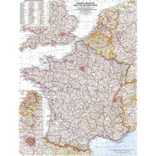
This detailed map of France, Belgium and the Netherlands is unique in its focus on these three particular countries. Features a list of the "départements", or administrative divisions, for each country and their capitals. Includes inset maps of Paris, Amsterdam, and Brussels. Published in June 1960.
Details
This detailed map of France, Belgium and the Netherlands is unique in its focus on these three particular countries. Features a list of the "départements", or administrative divisions, for each country and their capitals. Includes inset maps of Paris, Amsterdam, and Brussels. Published in June 1960.
More Information
| SKU | ngmaps-HM19600600-1 |
|---|---|
| Flat Size | 19 x 25 in |
| Publication Date | 1960 |
| Publisher Name | National Geographic |
Reviews
{{title}}
{{detail}}
No reviews yet ...
Have an opinion? Help others decide. Share your knowledge about this product by submitting a review.
{{/items}}
{{#previousPage}}
Previous Page
{{/previousPage}}
{{#load-more-src}}
Next Page
{{/load-more-src}}
★★★★★
★★★★★