Mounted Police Stations and Patrols
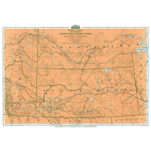
Contained within the Historical Maps, 1639 to 1949, Atlas of Canada map series, is a reproduction of an 1888 map compiled by Surveys and Mapping Branch of Energy Mines and Resources [now Natural Resources Canada] to commemorate the 1973 centenary of the RCMP. The map shows stations and patrol routes in the North-West Territories during 1888. The area covered corresponds to present-day southeastern Alberta and southern Saskatchewan. The map has a great deal of information about Indian lands, showing treaty areas, Indian reserves, and giving populations on the reserves.
Details
Contained within the Historical Maps, 1639 to 1949, Atlas of Canada map series, is a reproduction of an 1888 map compiled by Surveys and Mapping Branch of Energy Mines and Resources [now Natural Resources Canada] to commemorate the 1973 centenary of the RCMP. The map shows stations and patrol routes in the North-West Territories during 1888. The area covered corresponds to present-day southeastern Alberta and southern Saskatchewan. The map has a great deal of information about Indian lands, showing treaty areas, Indian reserves, and giving populations on the reserves.
More Information
| SKU | nrcan-MCR2308-1 |
|---|---|
| Flat Size | 42 x 30 in |
| Publication Date | 1980 |
| Publisher Name | Natural Resources Canada |
Reviews
{{title}}
{{detail}}