Carte Generale Des Decouvertes De Lamiral De Fonte 1752 - Published 1892
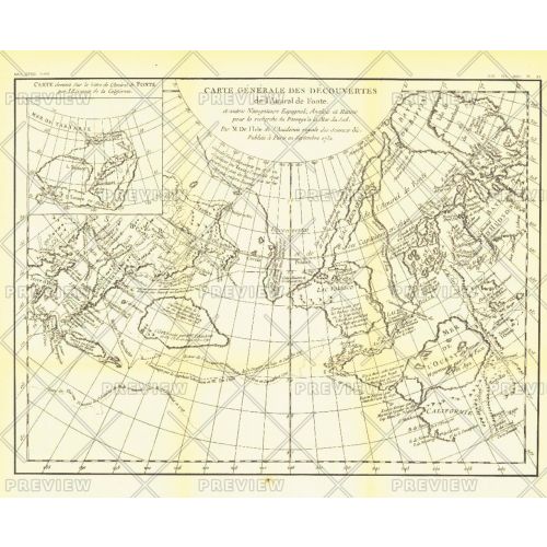
The "Carte Generale des Decouvertes de l'Amiral de Fonte" map is a black and white antique map created by Joseph-Nicolas De l'Isle in 1752 showing the supposed discoveries of Spanish explorer Admiral de la Fuente and the tracks of Spanish, English, and Russian navigators. These mythical "discoveries" included a Northwest Passage. Published in February 1892, it accompanied the article "The Cartography and Observations of Bering's First Voyage."
Details
The "Carte Generale des Decouvertes de l'Amiral de Fonte" map is a black and white antique map created by Joseph-Nicolas De l'Isle in 1752 showing the supposed discoveries of Spanish explorer Admiral de la Fuente and the tracks of Spanish, English, and Russian navigators. These mythical "discoveries" included a Northwest Passage. Published in February 1892, it accompanied the article "The Cartography and Observations of Bering's First Voyage."
More Information
| SKU | ngmaps-HM18920200-1 |
|---|---|
| Flat Size | 16 x 13 in |
| Publication Date | 1892 |
| Publisher Name | National Geographic |
Reviews
{{title}}
{{detail}}