Antarctica Satellite
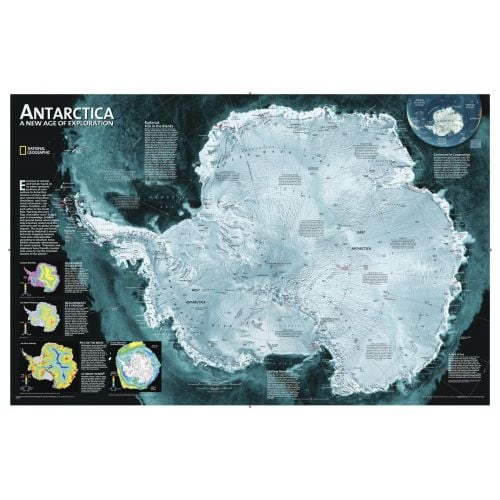
A striking view of Antarctica's terrain, compiled from 4,500 satellite scans. Additional inset maps show surface elevation, ice sheet thickness, velocity of ice flow, and sea ice movement and windflow.
Details
A striking view of Antarctica's terrain, compiled from 4,500 satellite scans. Additional inset maps show surface elevation, ice sheet thickness, velocity of ice flow, and sea ice movement and windflow.
More Information
| SKU | ngmaps-RE00620091-1 |
|---|---|
| Map Scale | 1:9,200,000 |
| Flat Size | 33 x 22 inches |
| Publication Date | 2006 |
| Publisher Name | National Geographic |
Reviews
{{title}}
{{detail}}
No reviews yet ...
Have an opinion? Help others decide. Share your knowledge about this product by submitting a review.
{{/items}}
{{#previousPage}}
Previous Page
{{/previousPage}}
{{#load-more-src}}
Next Page
{{/load-more-src}}
★★★★★
★★★★★
Related Products
Pacific Ocean Floor - Atlas of the World, 10th Edition
As low as
$33.99
Atlantic Ocean Floor - Atlas of the World, 10th Edition
As low as
$33.99
Indian Ocean Floor - Atlas of the World, 10th Edition
As low as
$33.99
Arctic Ocean Floor - Atlas of the World, 10th Edition
As low as
$33.99
Ocean Floor around Antarctica - Atlas of the World, 10th ...
As low as
$33.99