D-Day - Ste. Marie du Mont - Normandy - Wall Map
Details
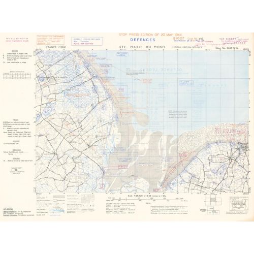
D-Day map dated 19 May, 1944. Covering the area between Utah and Omaha Beaches and the Town of Sainte. Marie du Mont. This Map was produced in the run up to D-Day by the Allies, as they planned the assault on Normandy. The Original Maps have been digitally scanned at high resolution in Full Colour.
More Information
| SKU | xyz-dday-stemarie-1 |
|---|---|
| Flat Size | 28.25 x 21 in |
| Publication Date | 1944 |
| Publisher Name | XYZ Maps |
Reviews
{{title}}
{{detail}}
No reviews yet ...
Have an opinion? Help others decide. Share your knowledge about this product by submitting a review.
{{/items}}
{{#previousPage}}
Previous Page
{{/previousPage}}
{{#load-more-src}}
Next Page
{{/load-more-src}}
★★★★★
★★★★★