West Indies and Central America - Published 1970
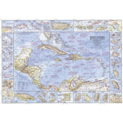
This wonderfully detailed map of the West Indies and Central America includes inset maps of over thirty islands, four cities, and the Panama Canal. A particularly unique feature of this map is the splashdown points of various space missions. Published in January 1970 to accompany the article "The Netherlands Antilles: Holland in the Caribbean."
Details
This wonderfully detailed map of the West Indies and Central America includes inset maps of over thirty islands, four cities, and the Panama Canal. A particularly unique feature of this map is the splashdown points of various space missions. Published in January 1970 to accompany the article "The Netherlands Antilles: Holland in the Caribbean."
More Information
| SKU | ngmaps-HM19700100-1 |
|---|---|
| Flat Size | 38 x 26.5 in |
| Publication Date | 1970 |
| Publisher Name | National Geographic |
Reviews
{{title}}
{{detail}}
No reviews yet ...
Have an opinion? Help others decide. Share your knowledge about this product by submitting a review.
{{/items}}
{{#previousPage}}
Previous Page
{{/previousPage}}
{{#load-more-src}}
Next Page
{{/load-more-src}}
★★★★★
★★★★★